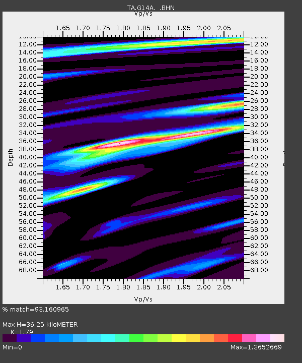
G14A Jackson, MT, USA - Earthquake Result Viewer
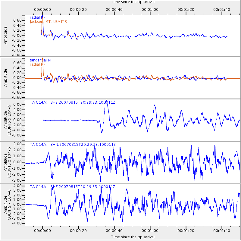
Earthquake location: Andreanof Islands, Aleutian Is.
Earthquake latitude/longitude: 50.3/-177.5
Earthquake time(UTC): 2007/08/15 (227) 20:22:11 GMT
Earthquake Depth: 9.0 km
Earthquake Magnitude: 6.3 MB, 6.2 MS, 6.4 MW, 5.9 ML
Earthquake Catalog/Contributor: WHDF/NEIC
Network: TA USArray Transportable Network (new EarthScope stations)
Station: G14A Jackson, MT, USA
Lat/Lon: 45.24 N/113.46 W
Elevation: 2140 m
Distance: 42.2 deg
Az: 71.169 deg
Baz: 300.822 deg
Ray Param: 0.073328756
Estimated Moho Depth: 36.25 km
Estimated Crust Vp/Vs: 1.79
Assumed Crust Vp: 6.577 km/s
Estimated Crust Vs: 3.674 km/s
Estimated Crust Poisson's Ratio: 0.27
Radial Match: 93.160965 %
Radial Bump: 400
Transverse Match: 85.91089 %
Transverse Bump: 400
SOD ConfigId: 2564
Insert Time: 2010-03-06 05:07:08.820 +0000
GWidth: 2.5
Max Bumps: 400
Tol: 0.001

Signal To Noise

ChannelStoNSTALTA
TA:G14A: :BHN:20070815T20:29:33.100011Z5.84937957.75708E-71.3261372E-7
TA:G14A: :BHE:20070815T20:29:33.100011Z9.4239681.2746563E-61.3525684E-7
TA:G14A: :BHZ:20070815T20:29:33.100011Z23.0842272.3084938E-61.0000308E-7
Arrivals
Ps4.7 SECOND
PpPs14 SECOND
PsPs/PpSs19 SECOND