G14A Jackson, MT, USA - Earthquake Result Viewer
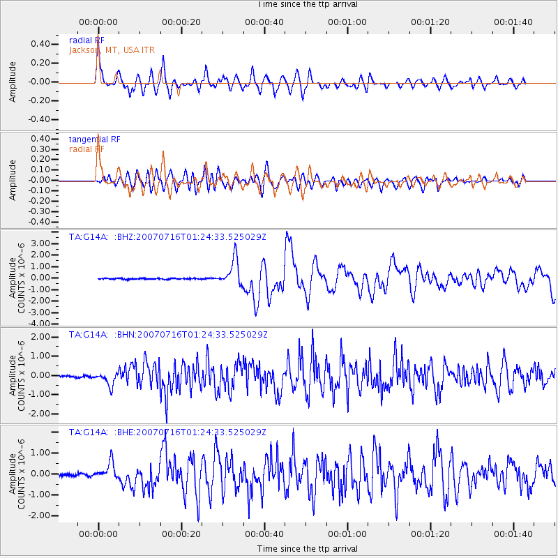
Earthquake location: Near West Coast Of Honshu, Japan
Earthquake latitude/longitude: 37.5/138.4
Earthquake time(UTC): 2007/07/16 (197) 01:13:22 GMT
Earthquake Depth: 12 km
Earthquake Magnitude: 6.5 MB, 6.4 MS, 6.6 MW, 6.5 MW
Earthquake Catalog/Contributor: WHDF/NEIC
Network: TA USArray Transportable Network (new EarthScope stations)
Station: G14A Jackson, MT, USA
Lat/Lon: 45.24 N/113.46 W
Elevation: 2140 m
Distance: 75.2 deg
Az: 43.987 deg
Baz: 308.605 deg
Ray Param: 0.05180458
Estimated Moho Depth: 37.5 km
Estimated Crust Vp/Vs: 1.85
Assumed Crust Vp: 6.577 km/s
Estimated Crust Vs: 3.555 km/s
Estimated Crust Poisson's Ratio: 0.29
Radial Match: 82.701096 %
Radial Bump: 400
Transverse Match: 68.530525 %
Transverse Bump: 400
SOD ConfigId: 2564
Insert Time: 2010-03-06 05:07:14.523 +0000
GWidth: 2.5
Max Bumps: 400
Tol: 0.001

Signal To Noise

ChannelStoNSTALTA
TA:G14A: :BHN:20070716T01:24:33.525029Z8.4207883.4711667E-74.12214E-8
TA:G14A: :BHE:20070716T01:24:33.525029Z7.50982954.248753E-75.6575892E-8
TA:G14A: :BHZ:20070716T01:24:33.525029Z28.673621.1941969E-64.164793E-8
Arrivals
Ps5.0 SECOND
PpPs16 SECOND
PsPs/PpSs21 SECOND