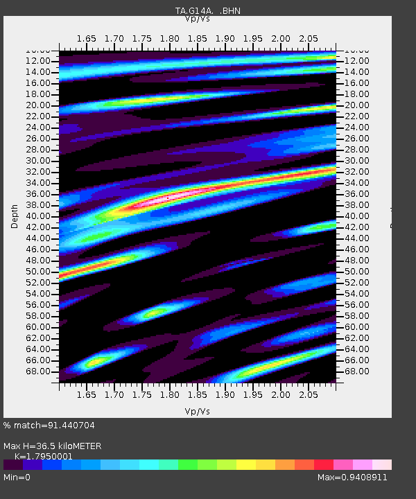
G14A Jackson, MT, USA - Earthquake Result Viewer
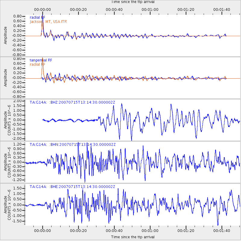
Earthquake location: Fox Islands, Aleutian Islands
Earthquake latitude/longitude: 52.5/-168.0
Earthquake time(UTC): 2007/07/15 (196) 13:08:00 GMT
Earthquake Depth: 10 km
Earthquake Magnitude: 5.8 MB, 5.9 MS, 6.1 MW, 6.0 MW
Earthquake Catalog/Contributor: WHDF/NEIC
Network: TA USArray Transportable Network (new EarthScope stations)
Station: G14A Jackson, MT, USA
Lat/Lon: 45.24 N/113.46 W
Elevation: 2140 m
Distance: 35.9 deg
Az: 79.282 deg
Baz: 301.72 deg
Ray Param: 0.07698809
Estimated Moho Depth: 36.5 km
Estimated Crust Vp/Vs: 1.80
Assumed Crust Vp: 6.577 km/s
Estimated Crust Vs: 3.664 km/s
Estimated Crust Poisson's Ratio: 0.27
Radial Match: 91.440704 %
Radial Bump: 400
Transverse Match: 80.78126 %
Transverse Bump: 400
SOD ConfigId: 2564
Insert Time: 2010-03-06 05:07:15.965 +0000
GWidth: 2.5
Max Bumps: 400
Tol: 0.001

Signal To Noise

ChannelStoNSTALTA
TA:G14A: :BHN:20070715T13:14:30.000002Z2.55644371.2017989E-74.7010577E-8
TA:G14A: :BHE:20070715T13:14:30.000002Z2.91752392.0400275E-76.992325E-8
TA:G14A: :BHZ:20070715T13:14:30.000002Z3.96063662.91609E-77.362681E-8
Arrivals
Ps4.8 SECOND
PpPs14 SECOND
PsPs/PpSs19 SECOND