
G14A Jackson, MT, USA - Earthquake Result Viewer
| ||||||||||||||||||
| ||||||||||||||||||
| ||||||||||||||||||
|
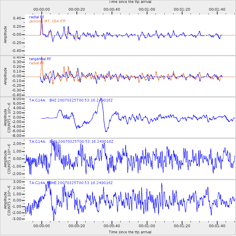
Signal To Noise
| Channel | StoN | STA | LTA |
| TA:G14A: :BHN:20070325T00:53:16.249016Z | 2.0674682 | 8.504308E-7 | 4.1133927E-7 |
| TA:G14A: :BHE:20070325T00:53:16.249016Z | 2.2419481 | 1.8204043E-6 | 8.119743E-7 |
| TA:G14A: :BHZ:20070325T00:53:16.249016Z | 2.7228596 | 5.327059E-6 | 1.9564206E-6 |
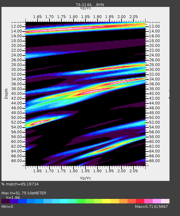
| Arrivals | |
| Ps | 5.4 SECOND |
| PpPs | 20 SECOND |
| PsPs/PpSs | 26 SECOND |

