You are here: Home > Network List > TA - USArray Transportable Network (new EarthScope stations) Stations List
> Station G14A Jackson, MT, USA > Earthquake Result Viewer
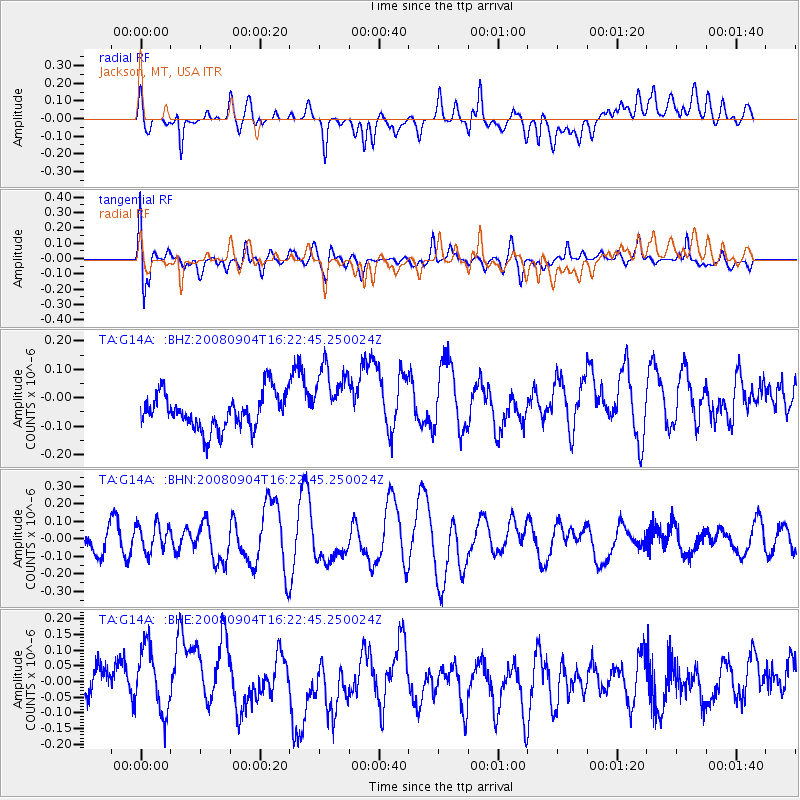
G14A Jackson, MT, USA - Earthquake Result Viewer
*The percent match for this event was below the threshold and hence no stack was calculated.
| Earthquake location: |
Kermadec Islands Region |
| Earthquake latitude/longitude: |
-31.6/-177.8 |
| Earthquake time(UTC): |
2008/09/04 (248) 16:09:51 GMT |
| Earthquake Depth: |
26 km |
| Earthquake Magnitude: |
5.5 MB, 5.9 MS, 5.8 MW, 5.7 MW |
| Earthquake Catalog/Contributor: |
WHDF/NEIC |
|
| Network: |
TA USArray Transportable Network (new EarthScope stations) |
| Station: |
G14A Jackson, MT, USA |
| Lat/Lon: |
45.24 N/113.46 W |
| Elevation: |
2140 m |
|
| Distance: |
96.2 deg |
| Az: |
39.832 deg |
| Baz: |
230.717 deg |
| Ray Param: |
$rayparam |
*The percent match for this event was below the threshold and hence was not used in the summary stack. |
|
| Radial Match: |
40.531025 % |
| Radial Bump: |
400 |
| Transverse Match: |
54.21904 % |
| Transverse Bump: |
400 |
| SOD ConfigId: |
2504 |
| Insert Time: |
2010-03-06 05:07:53.497 +0000 |
| GWidth: |
2.5 |
| Max Bumps: |
400 |
| Tol: |
0.001 |
|
Signal To Noise
| Channel | StoN | STA | LTA |
| TA:G14A: :BHN:20080904T16:22:45.250024Z | 1.5445896 | 7.986011E-8 | 5.1703125E-8 |
| TA:G14A: :BHE:20080904T16:22:45.250024Z | 1.6268566 | 1.13557824E-7 | 6.980199E-8 |
| TA:G14A: :BHZ:20080904T16:22:45.250024Z | 1.9135627 | 1.2039091E-7 | 6.291454E-8 |
| Arrivals |
| Ps | |
| PpPs | |
| PsPs/PpSs | |


