You are here: Home > Network List > TA - USArray Transportable Network (new EarthScope stations) Stations List
> Station G14A Jackson, MT, USA > Earthquake Result Viewer
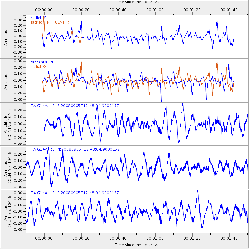
G14A Jackson, MT, USA - Earthquake Result Viewer
*The percent match for this event was below the threshold and hence no stack was calculated.
| Earthquake location: |
Vanuatu Islands |
| Earthquake latitude/longitude: |
-13.3/167.0 |
| Earthquake time(UTC): |
2008/09/05 (249) 12:35:43 GMT |
| Earthquake Depth: |
147 km |
| Earthquake Magnitude: |
5.6 MW, 5.3 MB, 5.6 MW |
| Earthquake Catalog/Contributor: |
WHDF/NEIC |
|
| Network: |
TA USArray Transportable Network (new EarthScope stations) |
| Station: |
G14A Jackson, MT, USA |
| Lat/Lon: |
45.24 N/113.46 W |
| Elevation: |
2140 m |
|
| Distance: |
92.1 deg |
| Az: |
44.05 deg |
| Baz: |
253.377 deg |
| Ray Param: |
$rayparam |
*The percent match for this event was below the threshold and hence was not used in the summary stack. |
|
| Radial Match: |
64.82908 % |
| Radial Bump: |
400 |
| Transverse Match: |
65.861534 % |
| Transverse Bump: |
344 |
| SOD ConfigId: |
2504 |
| Insert Time: |
2010-03-06 05:07:56.361 +0000 |
| GWidth: |
2.5 |
| Max Bumps: |
400 |
| Tol: |
0.001 |
|
Signal To Noise
| Channel | StoN | STA | LTA |
| TA:G14A: :BHN:20080905T12:48:04.900015Z | 2.1087074 | 1.9213998E-7 | 9.111742E-8 |
| TA:G14A: :BHE:20080905T12:48:04.900015Z | 0.5337855 | 5.0135103E-8 | 9.392369E-8 |
| TA:G14A: :BHZ:20080905T12:48:04.900015Z | 1.5269933 | 1.3810391E-7 | 9.044172E-8 |
| Arrivals |
| Ps | |
| PpPs | |
| PsPs/PpSs | |


