You are here: Home > Network List > TA - USArray Transportable Network (new EarthScope stations) Stations List
> Station G14A Jackson, MT, USA > Earthquake Result Viewer
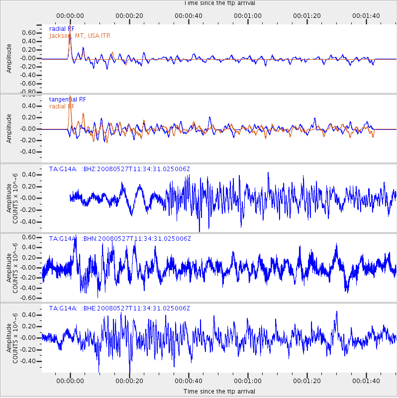
G14A Jackson, MT, USA - Earthquake Result Viewer
*The percent match for this event was below the threshold and hence no stack was calculated.
| Earthquake location: |
Near Coast Of Guatemala |
| Earthquake latitude/longitude: |
13.6/-91.0 |
| Earthquake time(UTC): |
2008/05/27 (148) 11:27:55 GMT |
| Earthquake Depth: |
26 km |
| Earthquake Magnitude: |
5.7 MW, 5.1 MS, 5.3 MB, 5.6 MW |
| Earthquake Catalog/Contributor: |
WHDF/NEIC |
|
| Network: |
TA USArray Transportable Network (new EarthScope stations) |
| Station: |
G14A Jackson, MT, USA |
| Lat/Lon: |
45.24 N/113.46 W |
| Elevation: |
2140 m |
|
| Distance: |
36.8 deg |
| Az: |
333.264 deg |
| Baz: |
141.747 deg |
| Ray Param: |
$rayparam |
*The percent match for this event was below the threshold and hence was not used in the summary stack. |
|
| Radial Match: |
70.919395 % |
| Radial Bump: |
400 |
| Transverse Match: |
63.589893 % |
| Transverse Bump: |
400 |
| SOD ConfigId: |
2504 |
| Insert Time: |
2010-03-06 05:08:35.654 +0000 |
| GWidth: |
2.5 |
| Max Bumps: |
400 |
| Tol: |
0.001 |
|
Signal To Noise
| Channel | StoN | STA | LTA |
| TA:G14A: :BHN:20080527T11:34:31.025006Z | 3.1816115 | 2.7717633E-7 | 8.7118224E-8 |
| TA:G14A: :BHE:20080527T11:34:31.025006Z | 1.3422773 | 9.7876274E-8 | 7.291808E-8 |
| TA:G14A: :BHZ:20080527T11:34:31.025006Z | 1.2392542 | 1.192209E-7 | 9.620374E-8 |
| Arrivals |
| Ps | |
| PpPs | |
| PsPs/PpSs | |


