You are here: Home > Network List > TA - USArray Transportable Network (new EarthScope stations) Stations List
> Station G14A Jackson, MT, USA > Earthquake Result Viewer
G14A Jackson, MT, USA - Earthquake Result Viewer
*The percent match for this event was below the threshold and hence no stack was calculated.
| Earthquake location: |
Arctic Ocean |
| Earthquake latitude/longitude: |
79.6/-116.1 |
| Earthquake time(UTC): |
2008/11/17 (322) 12:55:22 GMT |
| Earthquake Depth: |
7.0 km |
| Earthquake Magnitude: |
5.7 MW, 5.2 MS, 5.4 MB, 5.7 MW |
| Earthquake Catalog/Contributor: |
WHDF/NEIC |
|
| Network: |
TA USArray Transportable Network (new EarthScope stations) |
| Station: |
G14A Jackson, MT, USA |
| Lat/Lon: |
45.24 N/113.46 W |
| Elevation: |
2140 m |
|
| Distance: |
34.5 deg |
| Az: |
176.765 deg |
| Baz: |
359.172 deg |
| Ray Param: |
$rayparam |
*The percent match for this event was below the threshold and hence was not used in the summary stack. |
|
| Radial Match: |
65.29871 % |
| Radial Bump: |
400 |
| Transverse Match: |
63.645176 % |
| Transverse Bump: |
400 |
| SOD ConfigId: |
2658 |
| Insert Time: |
2010-03-06 05:08:59.064 +0000 |
| GWidth: |
2.5 |
| Max Bumps: |
400 |
| Tol: |
0.001 |
|
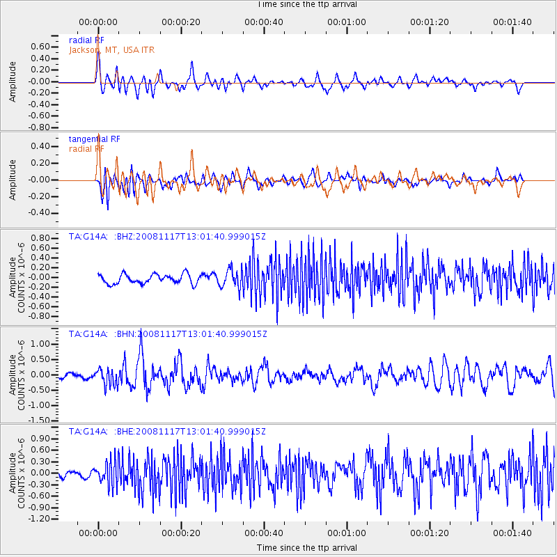
Signal To Noise
| Channel | StoN | STA | LTA |
| TA:G14A: :BHN:20081117T13:01:40.999015Z | 2.8498359 | 2.7068916E-7 | 9.4984124E-8 |
| TA:G14A: :BHE:20081117T13:01:40.999015Z | 2.3728445 | 3.0764335E-7 | 1.2965171E-7 |
| TA:G14A: :BHZ:20081117T13:01:40.999015Z | 1.9998202 | 1.8726317E-7 | 9.3640004E-8 |
| Arrivals |
| Ps | |
| PpPs | |
| PsPs/PpSs | |


