You are here: Home > Network List > TA - USArray Transportable Network (new EarthScope stations) Stations List
> Station G14A Jackson, MT, USA > Earthquake Result Viewer
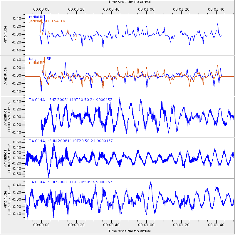
G14A Jackson, MT, USA - Earthquake Result Viewer
*The percent match for this event was below the threshold and hence no stack was calculated.
| Earthquake location: |
South Of Fiji Islands |
| Earthquake latitude/longitude: |
-22.2/-179.7 |
| Earthquake time(UTC): |
2008/11/19 (324) 20:38:58 GMT |
| Earthquake Depth: |
596 km |
| Earthquake Magnitude: |
5.8 MW, 5.2 MB, 5.8 MW |
| Earthquake Catalog/Contributor: |
WHDF/NEIC |
|
| Network: |
TA USArray Transportable Network (new EarthScope stations) |
| Station: |
G14A Jackson, MT, USA |
| Lat/Lon: |
45.24 N/113.46 W |
| Elevation: |
2140 m |
|
| Distance: |
90.1 deg |
| Az: |
40.292 deg |
| Baz: |
238.049 deg |
| Ray Param: |
$rayparam |
*The percent match for this event was below the threshold and hence was not used in the summary stack. |
|
| Radial Match: |
65.783936 % |
| Radial Bump: |
400 |
| Transverse Match: |
56.04496 % |
| Transverse Bump: |
400 |
| SOD ConfigId: |
2658 |
| Insert Time: |
2010-03-06 05:09:00.381 +0000 |
| GWidth: |
2.5 |
| Max Bumps: |
400 |
| Tol: |
0.001 |
|
Signal To Noise
| Channel | StoN | STA | LTA |
| TA:G14A: :BHN:20081119T20:50:24.900015Z | 2.1208346 | 3.6285658E-7 | 1.7109141E-7 |
| TA:G14A: :BHE:20081119T20:50:24.900015Z | 0.7147857 | 1.1280757E-7 | 1.5782012E-7 |
| TA:G14A: :BHZ:20081119T20:50:24.900015Z | 0.9384659 | 1.5823015E-7 | 1.6860511E-7 |
| Arrivals |
| Ps | |
| PpPs | |
| PsPs/PpSs | |


