You are here: Home > Network List > TA - USArray Transportable Network (new EarthScope stations) Stations List
> Station G14A Jackson, MT, USA > Earthquake Result Viewer
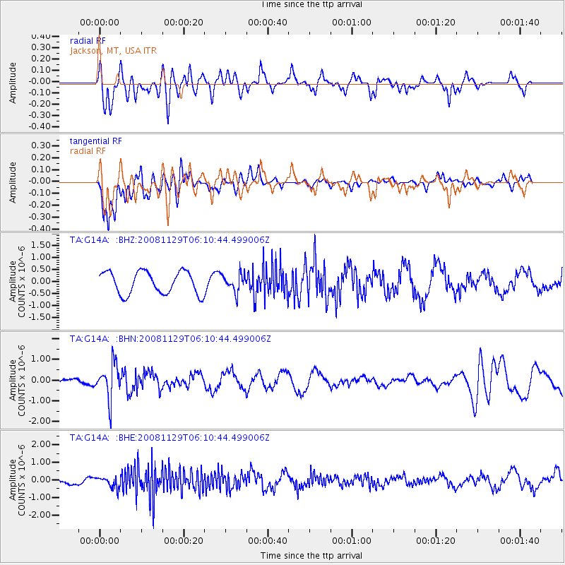
G14A Jackson, MT, USA - Earthquake Result Viewer
*The percent match for this event was below the threshold and hence no stack was calculated.
| Earthquake location: |
Fiji Islands Region |
| Earthquake latitude/longitude: |
-18.7/-177.7 |
| Earthquake time(UTC): |
2008/11/29 (334) 05:59:16 GMT |
| Earthquake Depth: |
386 km |
| Earthquake Magnitude: |
5.7 MB, 6.0 MW, 5.9 MW |
| Earthquake Catalog/Contributor: |
WHDF/NEIC |
|
| Network: |
TA USArray Transportable Network (new EarthScope stations) |
| Station: |
G14A Jackson, MT, USA |
| Lat/Lon: |
45.24 N/113.46 W |
| Elevation: |
2140 m |
|
| Distance: |
86.3 deg |
| Az: |
39.622 deg |
| Baz: |
238.826 deg |
| Ray Param: |
$rayparam |
*The percent match for this event was below the threshold and hence was not used in the summary stack. |
|
| Radial Match: |
65.35534 % |
| Radial Bump: |
400 |
| Transverse Match: |
73.48914 % |
| Transverse Bump: |
400 |
| SOD ConfigId: |
2658 |
| Insert Time: |
2010-03-06 05:09:09.403 +0000 |
| GWidth: |
2.5 |
| Max Bumps: |
400 |
| Tol: |
0.001 |
|
Signal To Noise
| Channel | StoN | STA | LTA |
| TA:G14A: :BHN:20081129T06:10:44.499006Z | 3.0057766 | 8.681509E-7 | 2.8882747E-7 |
| TA:G14A: :BHE:20081129T06:10:44.499006Z | 1.0292603 | 3.1207372E-7 | 3.0320194E-7 |
| TA:G14A: :BHZ:20081129T06:10:44.499006Z | 0.78355265 | 3.6396955E-7 | 4.6451194E-7 |
| Arrivals |
| Ps | |
| PpPs | |
| PsPs/PpSs | |


