You are here: Home > Network List > TA - USArray Transportable Network (new EarthScope stations) Stations List
> Station G14A Jackson, MT, USA > Earthquake Result Viewer
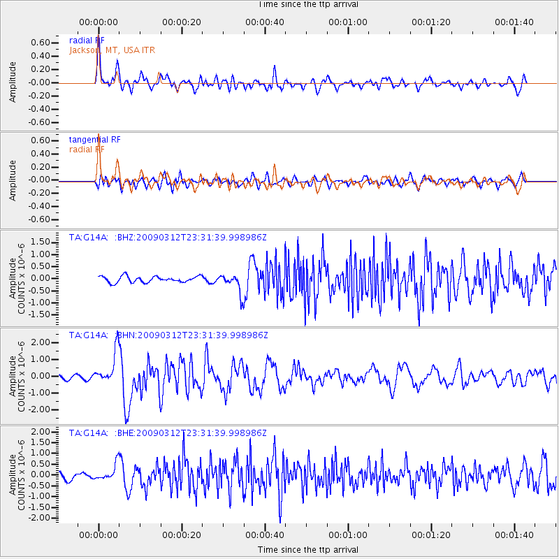
G14A Jackson, MT, USA - Earthquake Result Viewer
*The percent match for this event was below the threshold and hence no stack was calculated.
| Earthquake location: |
South Of Panama |
| Earthquake latitude/longitude: |
5.7/-82.8 |
| Earthquake time(UTC): |
2009/03/12 (071) 23:23:34 GMT |
| Earthquake Depth: |
9.0 km |
| Earthquake Magnitude: |
6.1 MB, 5.9 MS, 6.3 MW, 6.2 MW |
| Earthquake Catalog/Contributor: |
WHDF/NEIC |
|
| Network: |
TA USArray Transportable Network (new EarthScope stations) |
| Station: |
G14A Jackson, MT, USA |
| Lat/Lon: |
45.24 N/113.46 W |
| Elevation: |
2140 m |
|
| Distance: |
47.6 deg |
| Az: |
330.772 deg |
| Baz: |
136.544 deg |
| Ray Param: |
$rayparam |
*The percent match for this event was below the threshold and hence was not used in the summary stack. |
|
| Radial Match: |
76.317566 % |
| Radial Bump: |
400 |
| Transverse Match: |
76.953575 % |
| Transverse Bump: |
400 |
| SOD ConfigId: |
2658 |
| Insert Time: |
2010-03-06 05:09:14.535 +0000 |
| GWidth: |
2.5 |
| Max Bumps: |
400 |
| Tol: |
0.001 |
|
Signal To Noise
| Channel | StoN | STA | LTA |
| TA:G14A: :BHN:20090312T23:31:39.998986Z | 6.1353407 | 1.0130848E-6 | 1.6512281E-7 |
| TA:G14A: :BHE:20090312T23:31:39.998986Z | 2.7872813 | 3.804872E-7 | 1.3650836E-7 |
| TA:G14A: :BHZ:20090312T23:31:39.998986Z | 3.3772435 | 4.2302273E-7 | 1.252568E-7 |
| Arrivals |
| Ps | |
| PpPs | |
| PsPs/PpSs | |


