You are here: Home > Network List > TA - USArray Transportable Network (new EarthScope stations) Stations List
> Station G14A Jackson, MT, USA > Earthquake Result Viewer
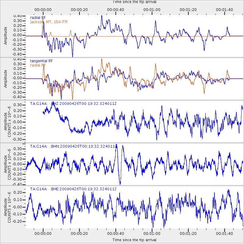
G14A Jackson, MT, USA - Earthquake Result Viewer
*The percent match for this event was below the threshold and hence no stack was calculated.
| Earthquake location: |
Kermadec Islands, New Zealand |
| Earthquake latitude/longitude: |
-30.3/-178.6 |
| Earthquake time(UTC): |
2009/04/26 (116) 00:06:53 GMT |
| Earthquake Depth: |
132 km |
| Earthquake Magnitude: |
5.5 MB, 6.1 MW, 6.1 MW |
| Earthquake Catalog/Contributor: |
WHDF/NEIC |
|
| Network: |
TA USArray Transportable Network (new EarthScope stations) |
| Station: |
G14A Jackson, MT, USA |
| Lat/Lon: |
45.24 N/113.46 W |
| Elevation: |
2140 m |
|
| Distance: |
95.6 deg |
| Az: |
40.093 deg |
| Baz: |
232.038 deg |
| Ray Param: |
$rayparam |
*The percent match for this event was below the threshold and hence was not used in the summary stack. |
|
| Radial Match: |
44.70749 % |
| Radial Bump: |
400 |
| Transverse Match: |
52.023373 % |
| Transverse Bump: |
400 |
| SOD ConfigId: |
2658 |
| Insert Time: |
2010-03-06 05:09:24.247 +0000 |
| GWidth: |
2.5 |
| Max Bumps: |
400 |
| Tol: |
0.001 |
|
Signal To Noise
| Channel | StoN | STA | LTA |
| TA:G14A: :BHN:20090426T00:19:32.324011Z | 1.0886536 | 6.562045E-8 | 6.02767E-8 |
| TA:G14A: :BHE:20090426T00:19:32.324011Z | 1.5206231 | 1.09908946E-7 | 7.2278894E-8 |
| TA:G14A: :BHZ:20090426T00:19:32.324011Z | 0.399665 | 6.552324E-8 | 1.639454E-7 |
| Arrivals |
| Ps | |
| PpPs | |
| PsPs/PpSs | |


