You are here: Home > Network List > TA - USArray Transportable Network (new EarthScope stations) Stations List
> Station G14A Jackson, MT, USA > Earthquake Result Viewer
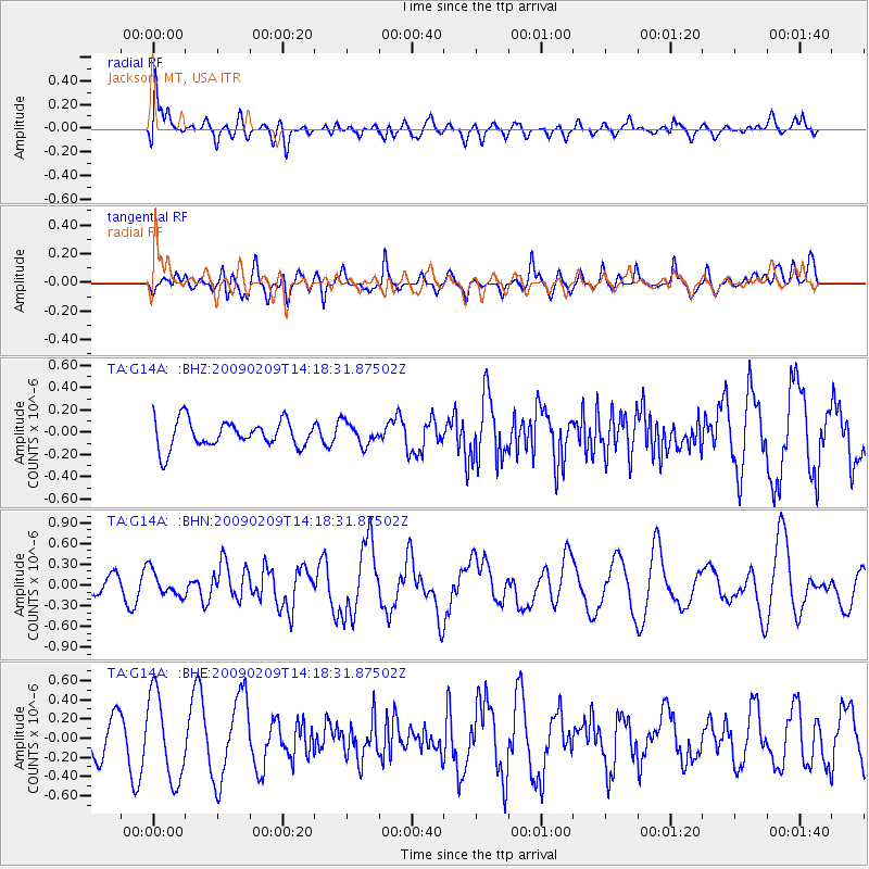
G14A Jackson, MT, USA - Earthquake Result Viewer
*The percent match for this event was below the threshold and hence no stack was calculated.
| Earthquake location: |
Near Coast Of Northern Peru |
| Earthquake latitude/longitude: |
-6.6/-81.2 |
| Earthquake time(UTC): |
2009/02/09 (040) 14:09:02 GMT |
| Earthquake Depth: |
15 km |
| Earthquake Magnitude: |
5.5 MB, 5.5 MS, 6.0 MW, 5.9 MW |
| Earthquake Catalog/Contributor: |
WHDF/NEIC |
|
| Network: |
TA USArray Transportable Network (new EarthScope stations) |
| Station: |
G14A Jackson, MT, USA |
| Lat/Lon: |
45.24 N/113.46 W |
| Elevation: |
2140 m |
|
| Distance: |
59.1 deg |
| Az: |
333.905 deg |
| Baz: |
141.788 deg |
| Ray Param: |
$rayparam |
*The percent match for this event was below the threshold and hence was not used in the summary stack. |
|
| Radial Match: |
57.222034 % |
| Radial Bump: |
400 |
| Transverse Match: |
56.02936 % |
| Transverse Bump: |
400 |
| SOD ConfigId: |
2658 |
| Insert Time: |
2010-03-06 05:09:45.256 +0000 |
| GWidth: |
2.5 |
| Max Bumps: |
400 |
| Tol: |
0.001 |
|
Signal To Noise
| Channel | StoN | STA | LTA |
| TA:G14A: :BHN:20090209T14:18:31.87502Z | 0.8809403 | 1.7980673E-7 | 2.0410774E-7 |
| TA:G14A: :BHE:20090209T14:18:31.87502Z | 2.7070217 | 4.4915865E-7 | 1.6592355E-7 |
| TA:G14A: :BHZ:20090209T14:18:31.87502Z | 0.80355364 | 9.8043664E-8 | 1.220126E-7 |
| Arrivals |
| Ps | |
| PpPs | |
| PsPs/PpSs | |


