
G13A Cobalt, ID, USA - Earthquake Result Viewer
| ||||||||||||||||||
| ||||||||||||||||||
| ||||||||||||||||||
|
Signal To Noise
| Channel | StoN | STA | LTA |
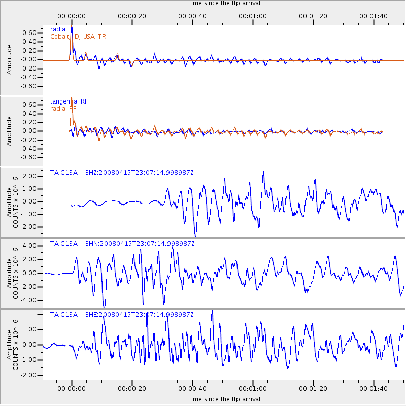
| TA:G13A: :BHN:20080415T23:07:14.998987Z | 11.197882 | 1.0066151E-6 | 8.9893355E-8 |
| TA:G13A: :BHE:20080415T23:07:14.998987Z | 2.1937962 | 3.1682754E-7 | 1.4441977E-7 |
| TA:G13A: :BHZ:20080415T23:07:14.998987Z | 3.1909134 | 4.3486497E-7 | 1.3628228E-7 |
| Arrivals | |
| Ps | 4.9 SECOND |
| PpPs | 15 SECOND |
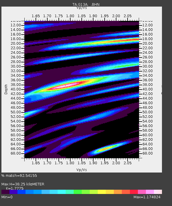
| PsPs/PpSs | 20 SECOND |

