
G13A Cobalt, ID, USA - Earthquake Result Viewer
| ||||||||||||||||||
| ||||||||||||||||||
| ||||||||||||||||||
|
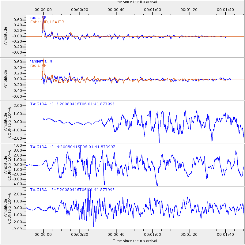
Signal To Noise
| Channel | StoN | STA | LTA |
| TA:G13A: :BHN:20080416T06:01:41.87399Z | 6.4157114 | 6.784742E-7 | 1.0575198E-7 |
| TA:G13A: :BHE:20080416T06:01:41.87399Z | 1.0856361 | 2.7554702E-7 | 2.5381158E-7 |
| TA:G13A: :BHZ:20080416T06:01:41.87399Z | 1.0968298 | 2.3891292E-7 | 2.1782132E-7 |
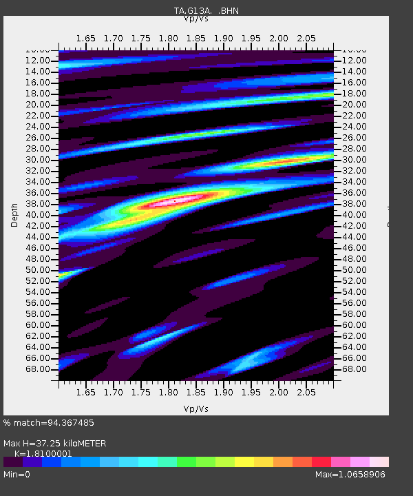
| Arrivals | |
| Ps | 4.9 SECOND |
| PpPs | 15 SECOND |
| PsPs/PpSs | 20 SECOND |

