
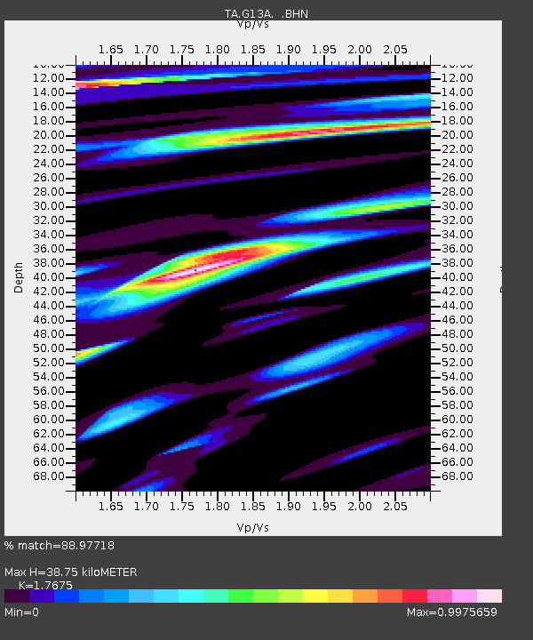
G13A Cobalt, ID, USA - Earthquake Result Viewer
| ||||||||||||||||||
| ||||||||||||||||||
| ||||||||||||||||||
|
Signal To Noise
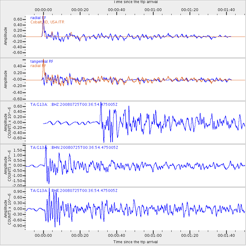
| Channel | StoN | STA | LTA |
| TA:G13A: :BHN:20080725T00:36:54.475005Z | 14.783367 | 8.3481376E-7 | 5.64698E-8 |
| TA:G13A: :BHE:20080725T00:36:54.475005Z | 8.896027 | 4.0503951E-7 | 4.5530385E-8 |
| TA:G13A: :BHZ:20080725T00:36:54.475005Z | 7.777022 | 3.061156E-7 | 3.9361545E-8 |
| Arrivals | |
| Ps | 4.8 SECOND |
| PpPs | 15 SECOND |
| PsPs/PpSs | 20 SECOND |

