You are here: Home > Network List > CI - Caltech Regional Seismic Network Stations List
> Station SMM Simmler, CA, USA > Earthquake Result Viewer
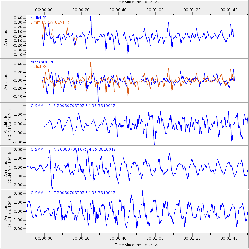
SMM Simmler, CA, USA - Earthquake Result Viewer
*The percent match for this event was below the threshold and hence no stack was calculated.
| Earthquake location: |
Ryukyu Islands, Japan |
| Earthquake latitude/longitude: |
27.5/128.3 |
| Earthquake time(UTC): |
2008/07/08 (190) 07:42:10 GMT |
| Earthquake Depth: |
43 km |
| Earthquake Magnitude: |
6.0 MB, 5.5 MS, 6.0 MW, 6.0 MW |
| Earthquake Catalog/Contributor: |
WHDF/NEIC |
|
| Network: |
CI Caltech Regional Seismic Network |
| Station: |
SMM Simmler, CA, USA |
| Lat/Lon: |
35.31 N/120.00 W |
| Elevation: |
599 m |
|
| Distance: |
90.2 deg |
| Az: |
49.466 deg |
| Baz: |
304.385 deg |
| Ray Param: |
$rayparam |
*The percent match for this event was below the threshold and hence was not used in the summary stack. |
|
| Radial Match: |
72.94188 % |
| Radial Bump: |
400 |
| Transverse Match: |
61.0454 % |
| Transverse Bump: |
400 |
| SOD ConfigId: |
2504 |
| Insert Time: |
2010-02-26 01:31:50.506 +0000 |
| GWidth: |
2.5 |
| Max Bumps: |
400 |
| Tol: |
0.001 |
|
Signal To Noise
| Channel | StoN | STA | LTA |
| CI:SMM: :BHN:20080708T07:54:35.381001Z | 4.745809 | 1.0763075E-6 | 2.2679114E-7 |
| CI:SMM: :BHE:20080708T07:54:35.381001Z | 0.3928129 | 2.9949308E-7 | 7.6243185E-7 |
| CI:SMM: :BHZ:20080708T07:54:35.381001Z | 0.90143305 | 4.2811078E-7 | 4.7492244E-7 |
| Arrivals |
| Ps | |
| PpPs | |
| PsPs/PpSs | |


