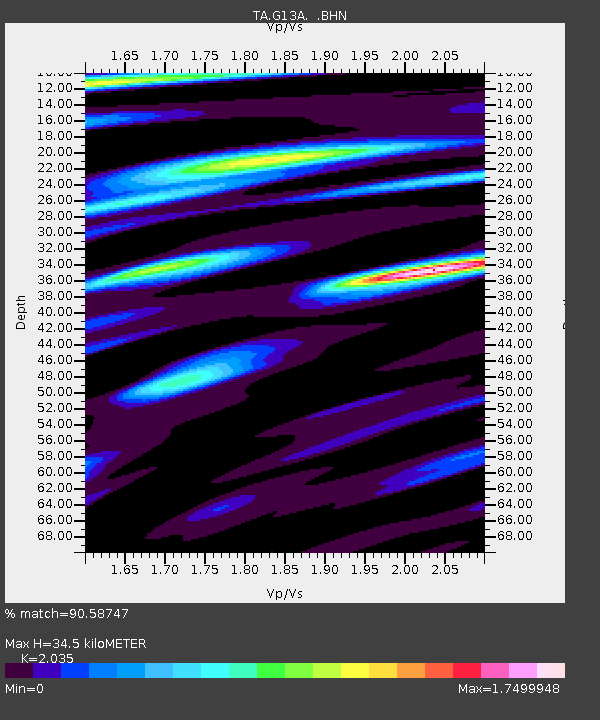
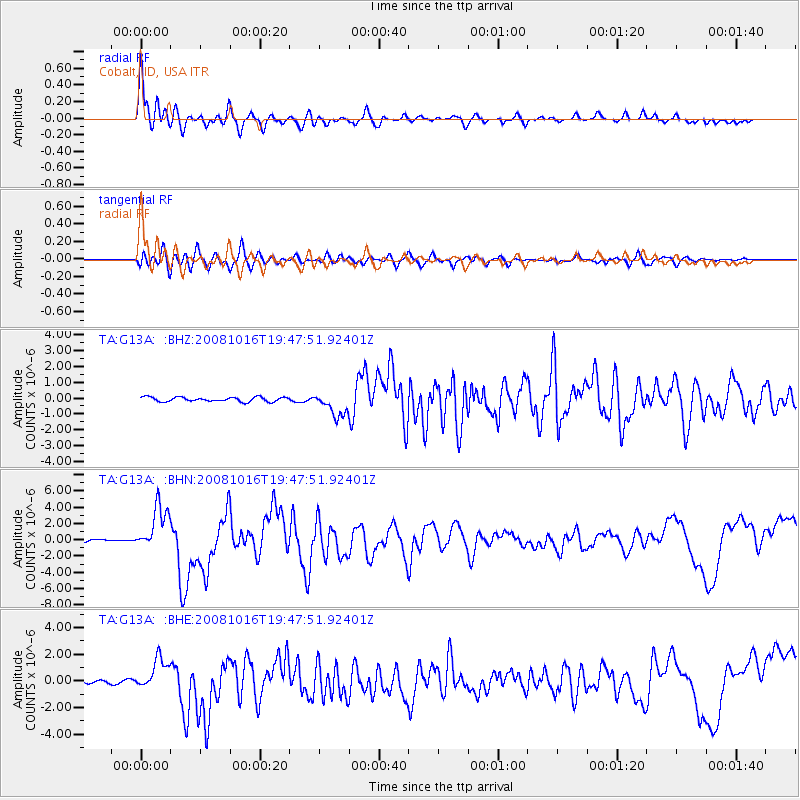
G13A Cobalt, ID, USA - Earthquake Result Viewer

Earthquake location: Near Coast Of Chiapas, Mexico
Earthquake latitude/longitude: 14.4/-92.4
Earthquake time(UTC): 2008/10/16 (290) 19:41:25 GMT
Earthquake Depth: 24 km
Earthquake Magnitude: 6.1 MB, 6.6 MS, 6.7 MW, 6.6 MW
Earthquake Catalog/Contributor: WHDF/NEIC
Network: TA USArray Transportable Network (new EarthScope stations)
Station: G13A Cobalt, ID, USA
Lat/Lon: 45.09 N/114.23 W
Elevation: 1538 m
Distance: 35.7 deg
Az: 333.151 deg
Baz: 141.846 deg
Ray Param: 0.07702185
Estimated Moho Depth: 34.5 km
Estimated Crust Vp/Vs: 2.04
Assumed Crust Vp: 6.577 km/s
Estimated Crust Vs: 3.232 km/s
Estimated Crust Poisson's Ratio: 0.34
Radial Match: 90.58747 %
Radial Bump: 400
Transverse Match: 82.04523 %
Transverse Bump: 400
SOD ConfigId: 2556
Insert Time: 2010-03-06 05:10:46.386 +0000
GWidth: 2.5
Max Bumps: 400
Tol: 0.001

Signal To Noise

ChannelStoNSTALTA
TA:G13A: :BHN:20081016T19:47:51.92401Z14.0826392.7644662E-61.9630313E-7
TA:G13A: :BHE:20081016T19:47:51.92401Z7.50946241.1674101E-61.5545855E-7
TA:G13A: :BHZ:20081016T19:47:51.92401Z5.35583837.5464965E-71.4090224E-7
Arrivals
Ps5.8 SECOND
PpPs15 SECOND
PsPs/PpSs21 SECOND