You are here: Home > Network List > CI - Caltech Regional Seismic Network Stations List
> Station SMM Simmler, CA, USA > Earthquake Result Viewer
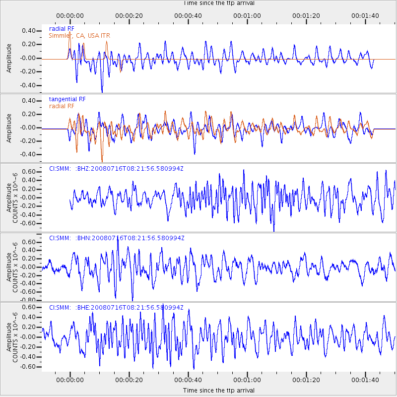
SMM Simmler, CA, USA - Earthquake Result Viewer
*The percent match for this event was below the threshold and hence no stack was calculated.
| Earthquake location: |
Samoa Islands Region |
| Earthquake latitude/longitude: |
-16.6/-173.0 |
| Earthquake time(UTC): |
2008/07/16 (198) 08:11:04 GMT |
| Earthquake Depth: |
10 km |
| Earthquake Magnitude: |
5.5 MB, 5.4 MS, 5.7 MW, 5.7 MW |
| Earthquake Catalog/Contributor: |
WHDF/NEIC |
|
| Network: |
CI Caltech Regional Seismic Network |
| Station: |
SMM Simmler, CA, USA |
| Lat/Lon: |
35.31 N/120.00 W |
| Elevation: |
599 m |
|
| Distance: |
72.0 deg |
| Az: |
43.348 deg |
| Baz: |
233.591 deg |
| Ray Param: |
$rayparam |
*The percent match for this event was below the threshold and hence was not used in the summary stack. |
|
| Radial Match: |
57.031254 % |
| Radial Bump: |
400 |
| Transverse Match: |
57.07986 % |
| Transverse Bump: |
400 |
| SOD ConfigId: |
2504 |
| Insert Time: |
2010-02-26 01:31:52.325 +0000 |
| GWidth: |
2.5 |
| Max Bumps: |
400 |
| Tol: |
0.001 |
|
Signal To Noise
| Channel | StoN | STA | LTA |
| CI:SMM: :BHN:20080716T08:21:56.580994Z | 2.456871 | 2.5516303E-7 | 1.0385691E-7 |
| CI:SMM: :BHE:20080716T08:21:56.580994Z | 1.132087 | 2.0611515E-7 | 1.8206651E-7 |
| CI:SMM: :BHZ:20080716T08:21:56.580994Z | 1.3478376 | 2.0459785E-7 | 1.5179711E-7 |
| Arrivals |
| Ps | |
| PpPs | |
| PsPs/PpSs | |


