
G13A Cobalt, ID, USA - Earthquake Result Viewer
| ||||||||||||||||||
| ||||||||||||||||||
| ||||||||||||||||||
|
Signal To Noise
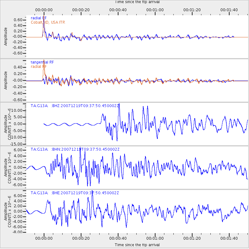
| Channel | StoN | STA | LTA |
| TA:G13A: :BHN:20071219T09:37:50.450002Z | 5.3289905 | 1.5187968E-6 | 2.8500648E-7 |
| TA:G13A: :BHE:20071219T09:37:50.450002Z | 4.655253 | 2.3975974E-6 | 5.1503054E-7 |
| TA:G13A: :BHZ:20071219T09:37:50.450002Z | 6.698849 | 4.0540535E-6 | 6.051866E-7 |
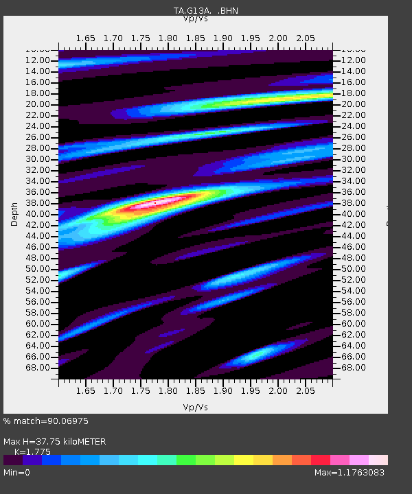
| Arrivals | |
| Ps | 4.8 SECOND |
| PpPs | 15 SECOND |
| PsPs/PpSs | 20 SECOND |

