
G13A Cobalt, ID, USA - Earthquake Result Viewer
| ||||||||||||||||||
| ||||||||||||||||||
| ||||||||||||||||||
|
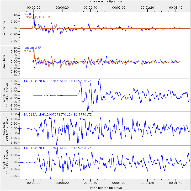
Signal To Noise
| Channel | StoN | STA | LTA |
| TA:G13A: :BHN:20070716T01:24:31.575017Z | 17.662521 | 3.4051166E-7 | 1.9278767E-8 |
| TA:G13A: :BHE:20070716T01:24:31.575017Z | 12.767106 | 4.8492797E-7 | 3.7982606E-8 |
| TA:G13A: :BHZ:20070716T01:24:31.575017Z | 25.852577 | 1.5513673E-6 | 6.0008226E-8 |
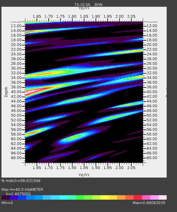
| Arrivals | |
| Ps | 3.8 SECOND |
| PpPs | 15 SECOND |
| PsPs/PpSs | 19 SECOND |

