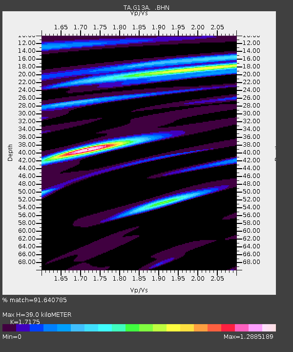
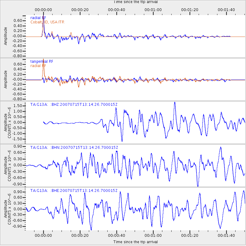
G13A Cobalt, ID, USA - Earthquake Result Viewer

Earthquake location: Fox Islands, Aleutian Islands
Earthquake latitude/longitude: 52.5/-168.0
Earthquake time(UTC): 2007/07/15 (196) 13:08:00 GMT
Earthquake Depth: 10 km
Earthquake Magnitude: 5.8 MB, 5.9 MS, 6.1 MW, 6.0 MW
Earthquake Catalog/Contributor: WHDF/NEIC
Network: TA USArray Transportable Network (new EarthScope stations)
Station: G13A Cobalt, ID, USA
Lat/Lon: 45.09 N/114.23 W
Elevation: 1538 m
Distance: 35.5 deg
Az: 79.994 deg
Baz: 301.752 deg
Ray Param: 0.07719672
Estimated Moho Depth: 39.0 km
Estimated Crust Vp/Vs: 1.72
Assumed Crust Vp: 6.577 km/s
Estimated Crust Vs: 3.829 km/s
Estimated Crust Poisson's Ratio: 0.24
Radial Match: 91.640785 %
Radial Bump: 370
Transverse Match: 73.32489 %
Transverse Bump: 400
SOD ConfigId: 2564
Insert Time: 2010-03-06 05:12:05.979 +0000
GWidth: 2.5
Max Bumps: 400
Tol: 0.001

Signal To Noise

ChannelStoNSTALTA
TA:G13A: :BHN:20070715T13:14:26.700015Z2.26382857.379845E-83.2598955E-8
TA:G13A: :BHE:20070715T13:14:26.700015Z2.61114981.5217606E-75.8279333E-8
TA:G13A: :BHZ:20070715T13:14:26.700015Z5.85623652.7278583E-74.6580396E-8
Arrivals
Ps4.6 SECOND
PpPs15 SECOND
PsPs/PpSs19 SECOND