
G13A Cobalt, ID, USA - Earthquake Result Viewer
| ||||||||||||||||||
| ||||||||||||||||||
| ||||||||||||||||||
|
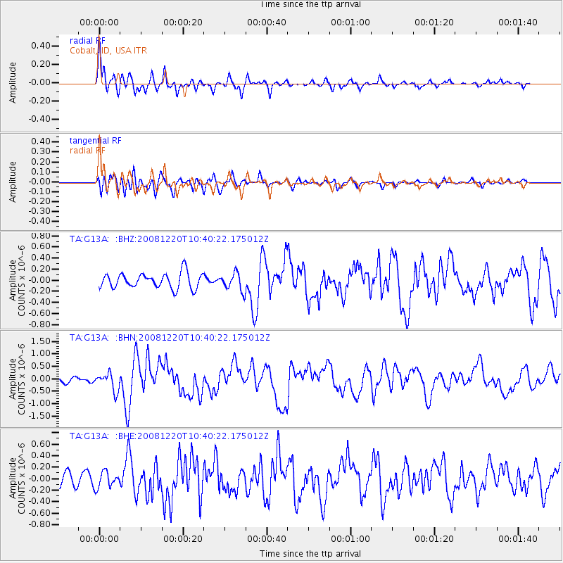
Signal To Noise
| Channel | StoN | STA | LTA |
| TA:G13A: :BHN:20081220T10:40:22.175012Z | 2.876356 | 3.6293267E-7 | 1.2617795E-7 |
| TA:G13A: :BHE:20081220T10:40:22.175012Z | 1.1466861 | 1.3378909E-7 | 1.16674556E-7 |
| TA:G13A: :BHZ:20081220T10:40:22.175012Z | 1.1827782 | 1.630746E-7 | 1.378742E-7 |
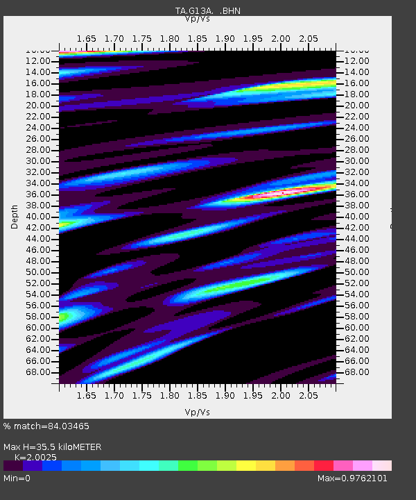
| Arrivals | |
| Ps | 5.6 SECOND |
| PpPs | 16 SECOND |
| PsPs/PpSs | 21 SECOND |

