You are here: Home > Network List > TA - USArray Transportable Network (new EarthScope stations) Stations List
> Station G13A Cobalt, ID, USA > Earthquake Result Viewer
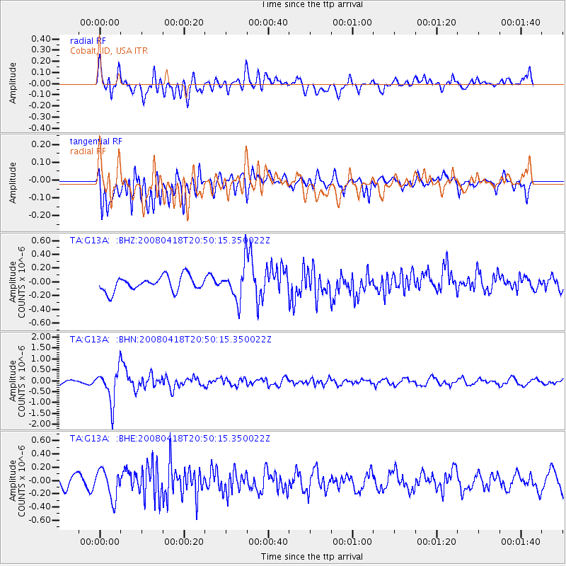
G13A Cobalt, ID, USA - Earthquake Result Viewer
*The percent match for this event was below the threshold and hence no stack was calculated.
| Earthquake location: |
Fiji Islands Region |
| Earthquake latitude/longitude: |
-17.3/-179.0 |
| Earthquake time(UTC): |
2008/04/18 (109) 20:39:07 GMT |
| Earthquake Depth: |
554 km |
| Earthquake Magnitude: |
5.9 MB, 6.3 MW, 6.3 MW |
| Earthquake Catalog/Contributor: |
WHDF/NEIC |
|
| Network: |
TA USArray Transportable Network (new EarthScope stations) |
| Station: |
G13A Cobalt, ID, USA |
| Lat/Lon: |
45.09 N/114.23 W |
| Elevation: |
1538 m |
|
| Distance: |
85.5 deg |
| Az: |
40.006 deg |
| Baz: |
240.094 deg |
| Ray Param: |
$rayparam |
*The percent match for this event was below the threshold and hence was not used in the summary stack. |
|
| Radial Match: |
55.04168 % |
| Radial Bump: |
400 |
| Transverse Match: |
63.610622 % |
| Transverse Bump: |
400 |
| SOD ConfigId: |
2504 |
| Insert Time: |
2010-03-06 05:13:06.847 +0000 |
| GWidth: |
2.5 |
| Max Bumps: |
400 |
| Tol: |
0.001 |
|
Signal To Noise
| Channel | StoN | STA | LTA |
| TA:G13A: :BHN:20080418T20:50:15.350022Z | 7.30848 | 7.722737E-7 | 1.0566817E-7 |
| TA:G13A: :BHE:20080418T20:50:15.350022Z | 1.8247826 | 2.2129475E-7 | 1.2127184E-7 |
| TA:G13A: :BHZ:20080418T20:50:15.350022Z | 2.4338105 | 2.6111005E-7 | 1.0728446E-7 |
| Arrivals |
| Ps | |
| PpPs | |
| PsPs/PpSs | |


