You are here: Home > Network List > CI - Caltech Regional Seismic Network Stations List
> Station SMM Simmler, CA, USA > Earthquake Result Viewer
SMM Simmler, CA, USA - Earthquake Result Viewer
*The percent match for this event was below the threshold and hence no stack was calculated.
| Earthquake location: |
Guatemala |
| Earthquake latitude/longitude: |
14.6/-91.2 |
| Earthquake time(UTC): |
2009/05/03 (123) 16:21:47 GMT |
| Earthquake Depth: |
124 km |
| Earthquake Magnitude: |
5.6 MB, 6.2 MW, 6.2 MW |
| Earthquake Catalog/Contributor: |
WHDF/NEIC |
|
| Network: |
CI Caltech Regional Seismic Network |
| Station: |
SMM Simmler, CA, USA |
| Lat/Lon: |
35.31 N/120.00 W |
| Elevation: |
599 m |
|
| Distance: |
33.1 deg |
| Az: |
313.795 deg |
| Baz: |
121.286 deg |
| Ray Param: |
$rayparam |
*The percent match for this event was below the threshold and hence was not used in the summary stack. |
|
| Radial Match: |
75.47096 % |
| Radial Bump: |
400 |
| Transverse Match: |
67.684006 % |
| Transverse Bump: |
400 |
| SOD ConfigId: |
2658 |
| Insert Time: |
2010-02-26 01:32:02.406 +0000 |
| GWidth: |
2.5 |
| Max Bumps: |
400 |
| Tol: |
0.001 |
|
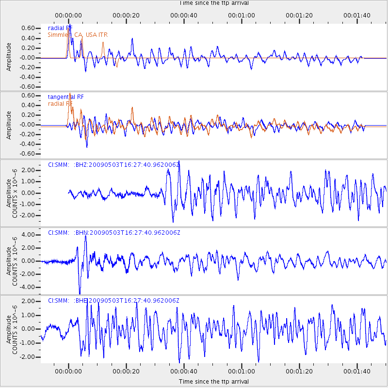
Signal To Noise
| Channel | StoN | STA | LTA |
| CI:SMM: :BHN:20090503T16:27:40.962006Z | 9.366991 | 1.6935093E-6 | 1.8079544E-7 |
| CI:SMM: :BHE:20090503T16:27:40.962006Z | 2.1432621 | 7.133456E-7 | 3.3283172E-7 |
| CI:SMM: :BHZ:20090503T16:27:40.962006Z | 3.9517794 | 8.12892E-7 | 2.0570278E-7 |
| Arrivals |
| Ps | |
| PpPs | |
| PsPs/PpSs | |


