You are here: Home > Network List > TA - USArray Transportable Network (new EarthScope stations) Stations List
> Station G13A Cobalt, ID, USA > Earthquake Result Viewer
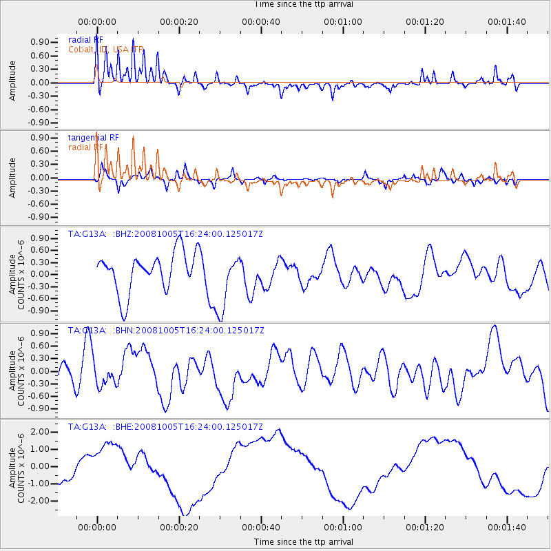
G13A Cobalt, ID, USA - Earthquake Result Viewer
*The percent match for this event was below the threshold and hence no stack was calculated.
| Earthquake location: |
Tajikistan-Xinjiang Border Reg. |
| Earthquake latitude/longitude: |
39.5/73.9 |
| Earthquake time(UTC): |
2008/10/05 (279) 16:11:10 GMT |
| Earthquake Depth: |
35 km |
| Earthquake Magnitude: |
5.6 MB |
| Earthquake Catalog/Contributor: |
WHDF/NEIC |
|
| Network: |
TA USArray Transportable Network (new EarthScope stations) |
| Station: |
G13A Cobalt, ID, USA |
| Lat/Lon: |
45.09 N/114.23 W |
| Elevation: |
1538 m |
|
| Distance: |
95.5 deg |
| Az: |
5.769 deg |
| Baz: |
353.697 deg |
| Ray Param: |
$rayparam |
*The percent match for this event was below the threshold and hence was not used in the summary stack. |
|
| Radial Match: |
28.109829 % |
| Radial Bump: |
180 |
| Transverse Match: |
63.320015 % |
| Transverse Bump: |
211 |
| SOD ConfigId: |
2556 |
| Insert Time: |
2010-03-06 05:13:23.318 +0000 |
| GWidth: |
2.5 |
| Max Bumps: |
400 |
| Tol: |
0.001 |
|
Signal To Noise
| Channel | StoN | STA | LTA |
| TA:G13A: :BHN:20081005T16:24:00.125017Z | 0.551475 | 2.1195882E-7 | 3.843489E-7 |
| TA:G13A: :BHE:20081005T16:24:00.125017Z | 2.6257818 | 1.3537759E-6 | 5.155706E-7 |
| TA:G13A: :BHZ:20081005T16:24:00.125017Z | 1.5265152 | 7.364127E-7 | 4.8241424E-7 |
| Arrivals |
| Ps | |
| PpPs | |
| PsPs/PpSs | |


