You are here: Home > Network List > TA - USArray Transportable Network (new EarthScope stations) Stations List
> Station G13A Cobalt, ID, USA > Earthquake Result Viewer
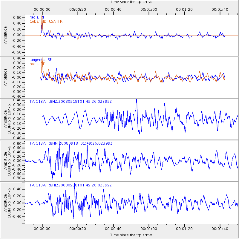
G13A Cobalt, ID, USA - Earthquake Result Viewer
*The percent match for this event was below the threshold and hence no stack was calculated.
| Earthquake location: |
Central East Pacific Rise |
| Earthquake latitude/longitude: |
-4.6/-106.0 |
| Earthquake time(UTC): |
2008/09/18 (262) 01:41:02 GMT |
| Earthquake Depth: |
10 km |
| Earthquake Magnitude: |
5.5 MB, 5.7 MS, 6.0 MW, 6.0 MW |
| Earthquake Catalog/Contributor: |
WHDF/NEIC |
|
| Network: |
TA USArray Transportable Network (new EarthScope stations) |
| Station: |
G13A Cobalt, ID, USA |
| Lat/Lon: |
45.09 N/114.23 W |
| Elevation: |
1538 m |
|
| Distance: |
50.0 deg |
| Az: |
352.388 deg |
| Baz: |
169.256 deg |
| Ray Param: |
$rayparam |
*The percent match for this event was below the threshold and hence was not used in the summary stack. |
|
| Radial Match: |
71.092926 % |
| Radial Bump: |
400 |
| Transverse Match: |
66.75408 % |
| Transverse Bump: |
400 |
| SOD ConfigId: |
2560 |
| Insert Time: |
2010-03-06 05:13:36.564 +0000 |
| GWidth: |
2.5 |
| Max Bumps: |
400 |
| Tol: |
0.001 |
|
Signal To Noise
| Channel | StoN | STA | LTA |
| TA:G13A: :BHN:20080918T01:49:26.02399Z | 4.2758884 | 2.4055072E-7 | 5.6257477E-8 |
| TA:G13A: :BHE:20080918T01:49:26.02399Z | 2.2430031 | 1.2270587E-7 | 5.4706067E-8 |
| TA:G13A: :BHZ:20080918T01:49:26.02399Z | 0.44369015 | 4.0321925E-8 | 9.0878565E-8 |
| Arrivals |
| Ps | |
| PpPs | |
| PsPs/PpSs | |


