You are here: Home > Network List > CI - Caltech Regional Seismic Network Stations List
> Station SMM Simmler, CA, USA > Earthquake Result Viewer
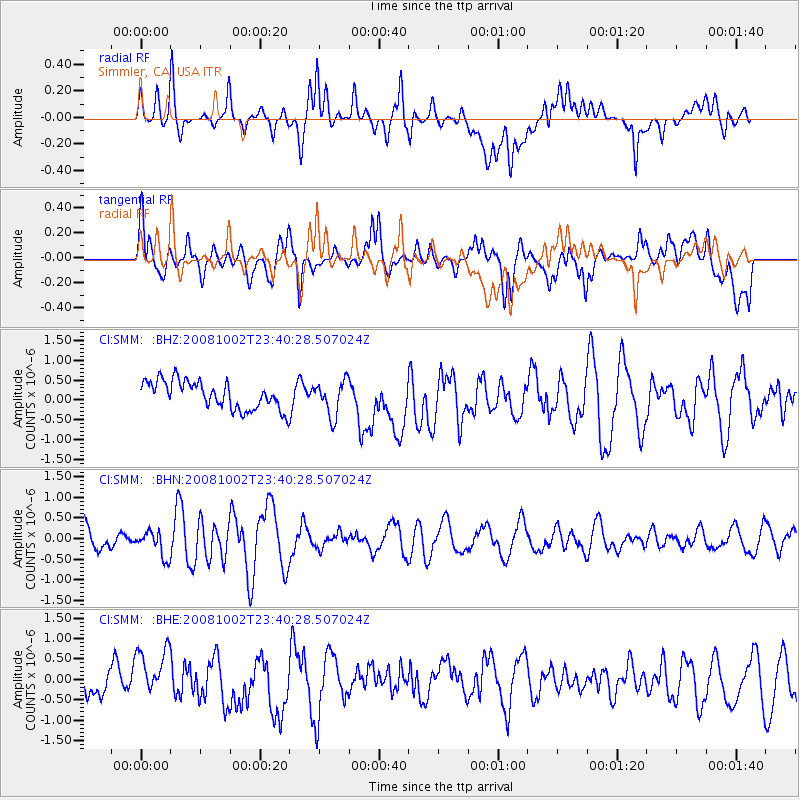
SMM Simmler, CA, USA - Earthquake Result Viewer
*The percent match for this event was below the threshold and hence no stack was calculated.
| Earthquake location: |
Southeast Of Loyalty Islands |
| Earthquake latitude/longitude: |
-23.0/169.9 |
| Earthquake time(UTC): |
2008/10/02 (276) 23:28:09 GMT |
| Earthquake Depth: |
10 km |
| Earthquake Magnitude: |
5.8 MB, 5.5 MS, 5.8 MW, 5.8 MW |
| Earthquake Catalog/Contributor: |
WHDF/NEIC |
|
| Network: |
CI Caltech Regional Seismic Network |
| Station: |
SMM Simmler, CA, USA |
| Lat/Lon: |
35.31 N/120.00 W |
| Elevation: |
599 m |
|
| Distance: |
88.2 deg |
| Az: |
50.317 deg |
| Baz: |
240.11 deg |
| Ray Param: |
$rayparam |
*The percent match for this event was below the threshold and hence was not used in the summary stack. |
|
| Radial Match: |
52.737648 % |
| Radial Bump: |
400 |
| Transverse Match: |
59.285915 % |
| Transverse Bump: |
400 |
| SOD ConfigId: |
2556 |
| Insert Time: |
2010-02-26 01:32:04.097 +0000 |
| GWidth: |
2.5 |
| Max Bumps: |
400 |
| Tol: |
0.001 |
|
Signal To Noise
| Channel | StoN | STA | LTA |
| CI:SMM: :BHN:20081002T23:40:28.507024Z | 0.8514104 | 3.1011498E-7 | 3.6423677E-7 |
| CI:SMM: :BHE:20081002T23:40:28.507024Z | 1.4110836 | 6.1436975E-7 | 4.3538864E-7 |
| CI:SMM: :BHZ:20081002T23:40:28.507024Z | 1.2642722 | 4.4279457E-7 | 3.5023675E-7 |
| Arrivals |
| Ps | |
| PpPs | |
| PsPs/PpSs | |


