You are here: Home > Network List > TA - USArray Transportable Network (new EarthScope stations) Stations List
> Station G13A Cobalt, ID, USA > Earthquake Result Viewer
G13A Cobalt, ID, USA - Earthquake Result Viewer
*The percent match for this event was below the threshold and hence no stack was calculated.
| Earthquake location: |
Tonga Islands Region |
| Earthquake latitude/longitude: |
-22.9/-175.2 |
| Earthquake time(UTC): |
2008/12/01 (336) 20:21:34 GMT |
| Earthquake Depth: |
39 km |
| Earthquake Magnitude: |
5.5 MB, 5.1 MS |
| Earthquake Catalog/Contributor: |
WHDF/NEIC |
|
| Network: |
TA USArray Transportable Network (new EarthScope stations) |
| Station: |
G13A Cobalt, ID, USA |
| Lat/Lon: |
45.09 N/114.23 W |
| Elevation: |
1538 m |
|
| Distance: |
87.5 deg |
| Az: |
38.305 deg |
| Baz: |
233.773 deg |
| Ray Param: |
$rayparam |
*The percent match for this event was below the threshold and hence was not used in the summary stack. |
|
| Radial Match: |
64.440674 % |
| Radial Bump: |
400 |
| Transverse Match: |
67.665726 % |
| Transverse Bump: |
315 |
| SOD ConfigId: |
2658 |
| Insert Time: |
2010-03-06 05:13:49.876 +0000 |
| GWidth: |
2.5 |
| Max Bumps: |
400 |
| Tol: |
0.001 |
|
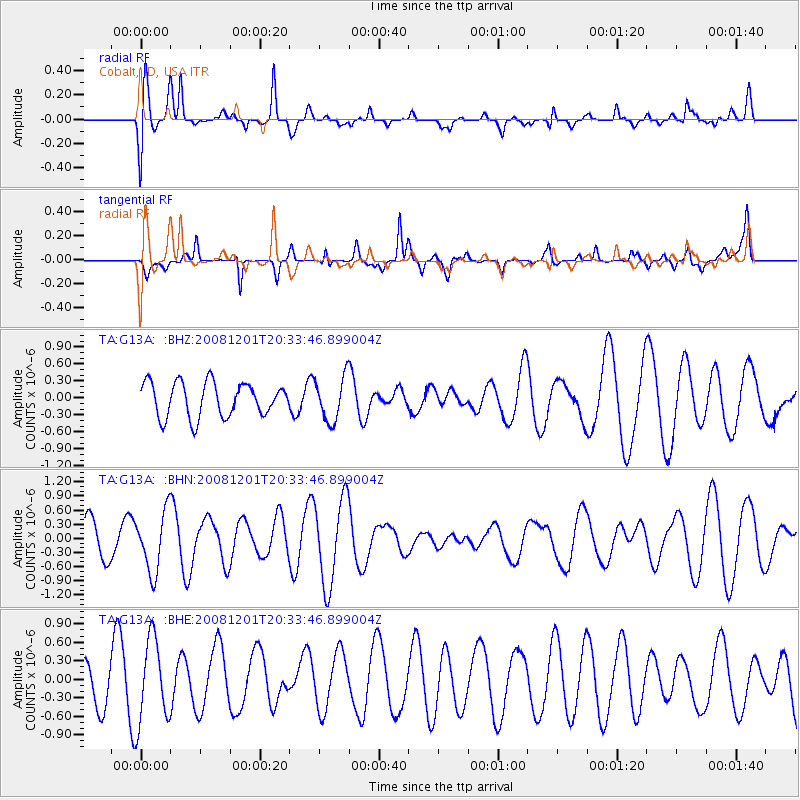
Signal To Noise
| Channel | StoN | STA | LTA |
| TA:G13A: :BHN:20081201T20:33:46.899004Z | 1.028503 | 6.359079E-7 | 6.1828496E-7 |
| TA:G13A: :BHE:20081201T20:33:46.899004Z | 3.2162364 | 6.731255E-7 | 2.0928981E-7 |
| TA:G13A: :BHZ:20081201T20:33:46.899004Z | 1.2908982 | 3.8893887E-7 | 3.0129323E-7 |
| Arrivals |
| Ps | |
| PpPs | |
| PsPs/PpSs | |


