You are here: Home > Network List > NE - New England Seismic Network Stations List
> Station PQI Presque Isle, ME, USA > Earthquake Result Viewer
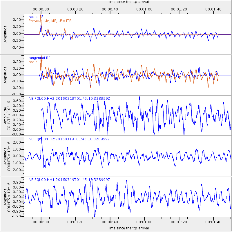
PQI Presque Isle, ME, USA - Earthquake Result Viewer
*The percent match for this event was below the threshold and hence no stack was calculated.
| Earthquake location: |
Andreanof Islands, Aleutian Is. |
| Earthquake latitude/longitude: |
51.5/-174.2 |
| Earthquake time(UTC): |
2016/03/19 (079) 01:35:12 GMT |
| Earthquake Depth: |
17 km |
| Earthquake Magnitude: |
6.0 MWW, 5.5 ML, 5.8 MWB |
| Earthquake Catalog/Contributor: |
NEIC PDE/NEIC COMCAT |
|
| Network: |
NE New England Seismic Network |
| Station: |
PQI Presque Isle, ME, USA |
| Lat/Lon: |
46.67 N/68.02 W |
| Elevation: |
162 m |
|
| Distance: |
63.5 deg |
| Az: |
47.625 deg |
| Baz: |
317.902 deg |
| Ray Param: |
$rayparam |
*The percent match for this event was below the threshold and hence was not used in the summary stack. |
|
| Radial Match: |
56.210445 % |
| Radial Bump: |
400 |
| Transverse Match: |
53.12535 % |
| Transverse Bump: |
400 |
| SOD ConfigId: |
1464191 |
| Insert Time: |
2016-04-02 02:16:31.614 +0000 |
| GWidth: |
2.5 |
| Max Bumps: |
400 |
| Tol: |
0.001 |
|
Signal To Noise
| Channel | StoN | STA | LTA |
| NE:PQI:00:HHZ:20160319T01:45:10.328999Z | 4.1130586 | 1.1524487E-6 | 2.8019264E-7 |
| NE:PQI:00:HH1:20160319T01:45:10.328999Z | 1.4336218 | 3.987985E-7 | 2.7817555E-7 |
| NE:PQI:00:HH2:20160319T01:45:10.328999Z | 1.2479001 | 3.8333772E-7 | 3.071862E-7 |
| Arrivals |
| Ps | |
| PpPs | |
| PsPs/PpSs | |


