You are here: Home > Network List > CI - Caltech Regional Seismic Network Stations List
> Station SMM Simmler, CA, USA > Earthquake Result Viewer
SMM Simmler, CA, USA - Earthquake Result Viewer
*The percent match for this event was below the threshold and hence no stack was calculated.
| Earthquake location: |
Tonga Islands |
| Earthquake latitude/longitude: |
-18.4/-175.4 |
| Earthquake time(UTC): |
2008/10/22 (296) 12:55:57 GMT |
| Earthquake Depth: |
233 km |
| Earthquake Magnitude: |
5.9 MB, 6.4 MW, 6.3 MW |
| Earthquake Catalog/Contributor: |
WHDF/NEIC |
|
| Network: |
CI Caltech Regional Seismic Network |
| Station: |
SMM Simmler, CA, USA |
| Lat/Lon: |
35.31 N/120.00 W |
| Elevation: |
599 m |
|
| Distance: |
74.9 deg |
| Az: |
44.18 deg |
| Baz: |
234.005 deg |
| Ray Param: |
$rayparam |
*The percent match for this event was below the threshold and hence was not used in the summary stack. |
|
| Radial Match: |
65.19989 % |
| Radial Bump: |
400 |
| Transverse Match: |
70.11419 % |
| Transverse Bump: |
400 |
| SOD ConfigId: |
2556 |
| Insert Time: |
2010-02-26 01:32:07.978 +0000 |
| GWidth: |
2.5 |
| Max Bumps: |
400 |
| Tol: |
0.001 |
|
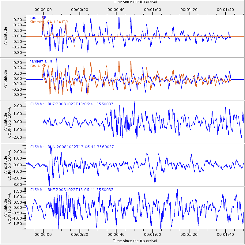
Signal To Noise
| Channel | StoN | STA | LTA |
| CI:SMM: :BHN:20081022T13:06:41.356003Z | 6.090339 | 1.3956975E-6 | 2.2916582E-7 |
| CI:SMM: :BHE:20081022T13:06:41.356003Z | 0.9929292 | 4.95462E-7 | 4.989903E-7 |
| CI:SMM: :BHZ:20081022T13:06:41.356003Z | 1.423947 | 4.3753445E-7 | 3.072688E-7 |
| Arrivals |
| Ps | |
| PpPs | |
| PsPs/PpSs | |


