You are here: Home > Network List > TA - USArray Transportable Network (new EarthScope stations) Stations List
> Station G13A Cobalt, ID, USA > Earthquake Result Viewer
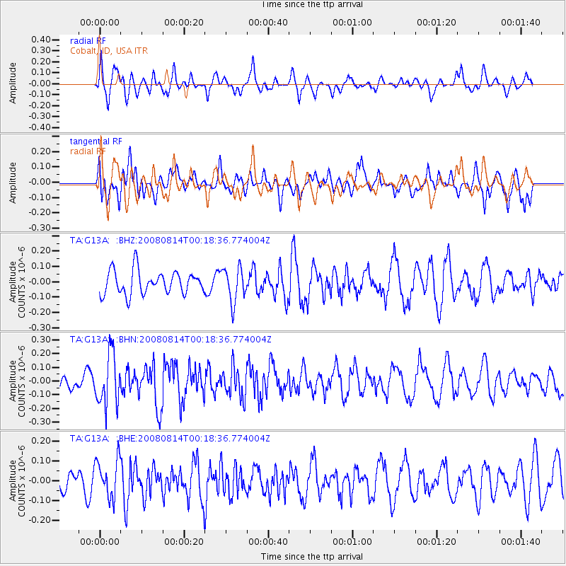
G13A Cobalt, ID, USA - Earthquake Result Viewer
*The percent match for this event was below the threshold and hence no stack was calculated.
| Earthquake location: |
Mariana Islands |
| Earthquake latitude/longitude: |
16.4/146.9 |
| Earthquake time(UTC): |
2008/08/14 (227) 00:06:40 GMT |
| Earthquake Depth: |
53 km |
| Earthquake Magnitude: |
5.5 MB, 4.8 MS |
| Earthquake Catalog/Contributor: |
WHDF/NEIC |
|
| Network: |
TA USArray Transportable Network (new EarthScope stations) |
| Station: |
G13A Cobalt, ID, USA |
| Lat/Lon: |
45.09 N/114.23 W |
| Elevation: |
1538 m |
|
| Distance: |
84.6 deg |
| Az: |
44.671 deg |
| Baz: |
287.731 deg |
| Ray Param: |
$rayparam |
*The percent match for this event was below the threshold and hence was not used in the summary stack. |
|
| Radial Match: |
48.27858 % |
| Radial Bump: |
400 |
| Transverse Match: |
52.420235 % |
| Transverse Bump: |
400 |
| SOD ConfigId: |
2504 |
| Insert Time: |
2010-03-06 05:14:40.916 +0000 |
| GWidth: |
2.5 |
| Max Bumps: |
400 |
| Tol: |
0.001 |
|
Signal To Noise
| Channel | StoN | STA | LTA |
| TA:G13A: :BHN:20080814T00:18:36.774004Z | 3.0111845 | 1.9051488E-7 | 6.3269084E-8 |
| TA:G13A: :BHE:20080814T00:18:36.774004Z | 1.1880046 | 9.850757E-8 | 8.2918504E-8 |
| TA:G13A: :BHZ:20080814T00:18:36.774004Z | 1.4890496 | 1.13453616E-7 | 7.619197E-8 |
| Arrivals |
| Ps | |
| PpPs | |
| PsPs/PpSs | |


