You are here: Home > Network List > CI - Caltech Regional Seismic Network Stations List
> Station SMM Simmler, CA, USA > Earthquake Result Viewer
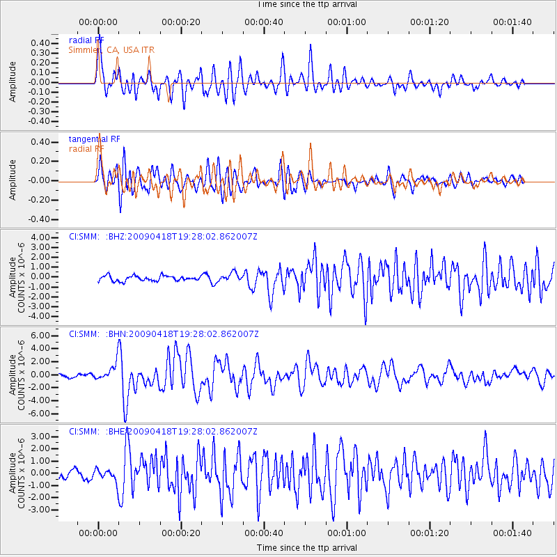
SMM Simmler, CA, USA - Earthquake Result Viewer
*The percent match for this event was below the threshold and hence no stack was calculated.
| Earthquake location: |
Kuril Islands |
| Earthquake latitude/longitude: |
46.0/151.4 |
| Earthquake time(UTC): |
2009/04/18 (108) 19:17:58 GMT |
| Earthquake Depth: |
35 km |
| Earthquake Magnitude: |
6.3 MB, 6.3 MS, 6.6 MW, 6.4 MW |
| Earthquake Catalog/Contributor: |
WHDF/NEIC |
|
| Network: |
CI Caltech Regional Seismic Network |
| Station: |
SMM Simmler, CA, USA |
| Lat/Lon: |
35.31 N/120.00 W |
| Elevation: |
599 m |
|
| Distance: |
64.7 deg |
| Az: |
64.699 deg |
| Baz: |
309.612 deg |
| Ray Param: |
$rayparam |
*The percent match for this event was below the threshold and hence was not used in the summary stack. |
|
| Radial Match: |
85.498215 % |
| Radial Bump: |
400 |
| Transverse Match: |
81.61729 % |
| Transverse Bump: |
400 |
| SOD ConfigId: |
2760 |
| Insert Time: |
2010-02-26 01:32:10.703 +0000 |
| GWidth: |
2.5 |
| Max Bumps: |
400 |
| Tol: |
0.001 |
|
Signal To Noise
| Channel | StoN | STA | LTA |
| CI:SMM: :BHN:20090418T19:28:02.862007Z | 5.9653473 | 1.4860251E-6 | 2.4910958E-7 |
| CI:SMM: :BHE:20090418T19:28:02.862007Z | 0.98196816 | 5.6275576E-7 | 5.730896E-7 |
| CI:SMM: :BHZ:20090418T19:28:02.862007Z | 1.6901449 | 4.384059E-7 | 2.5938954E-7 |
| Arrivals |
| Ps | |
| PpPs | |
| PsPs/PpSs | |


