You are here: Home > Network List > TA - USArray Transportable Network (new EarthScope stations) Stations List
> Station MDND Maddock, ND, USA > Earthquake Result Viewer
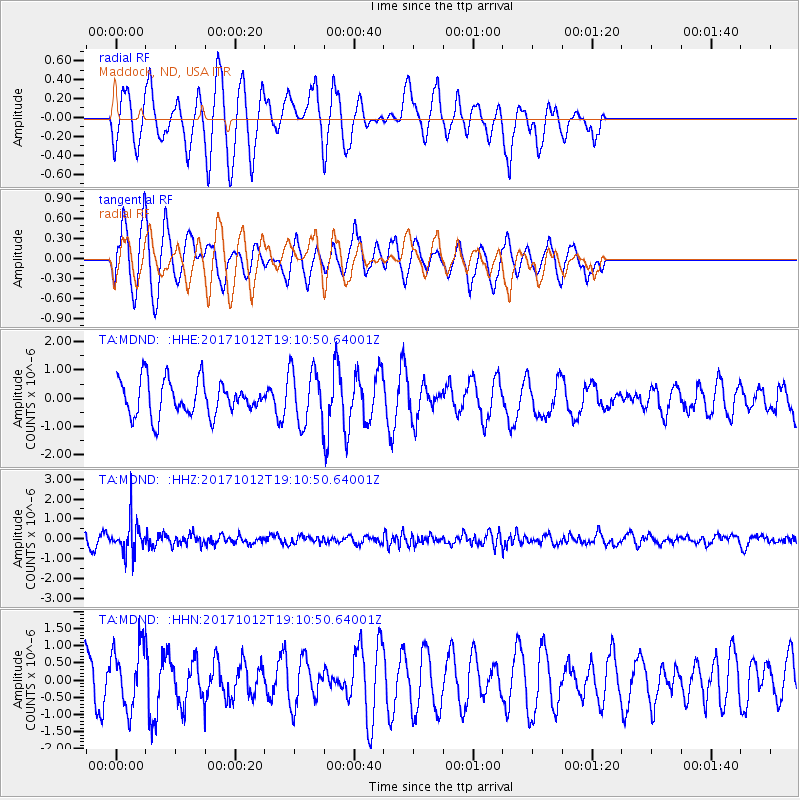
MDND Maddock, ND, USA - Earthquake Result Viewer
*The percent match for this event was below the threshold and hence no stack was calculated.
| Earthquake location: |
Cordoba Province, Argentina |
| Earthquake latitude/longitude: |
-31.0/-65.6 |
| Earthquake time(UTC): |
2017/10/12 (285) 18:59:08 GMT |
| Earthquake Depth: |
157 km |
| Earthquake Magnitude: |
5.5 Mww |
| Earthquake Catalog/Contributor: |
NEIC PDE/us |
|
| Network: |
TA USArray Transportable Network (new EarthScope stations) |
| Station: |
MDND Maddock, ND, USA |
| Lat/Lon: |
47.85 N/99.60 W |
| Elevation: |
479 m |
|
| Distance: |
84.2 deg |
| Az: |
337.738 deg |
| Baz: |
151.124 deg |
| Ray Param: |
$rayparam |
*The percent match for this event was below the threshold and hence was not used in the summary stack. |
|
| Radial Match: |
35.72563 % |
| Radial Bump: |
305 |
| Transverse Match: |
64.198425 % |
| Transverse Bump: |
393 |
| SOD ConfigId: |
13570011 |
| Insert Time: |
2019-04-28 23:45:59.305 +0000 |
| GWidth: |
2.5 |
| Max Bumps: |
400 |
| Tol: |
0.001 |
|
Signal To Noise
| Channel | StoN | STA | LTA |
| TA:MDND: :HHZ:20171012T19:10:50.64001Z | 3.3245368 | 8.257393E-7 | 2.4837723E-7 |
| TA:MDND: :HHN:20171012T19:10:50.64001Z | 1.8713866 | 9.1894066E-7 | 4.9104796E-7 |
| TA:MDND: :HHE:20171012T19:10:50.64001Z | 1.6794698 | 1.0200894E-6 | 6.0738773E-7 |
| Arrivals |
| Ps | |
| PpPs | |
| PsPs/PpSs | |


