You are here: Home > Network List > TA - USArray Transportable Network (new EarthScope stations) Stations List
> Station TUL3 Leonard, OK, USA > Earthquake Result Viewer
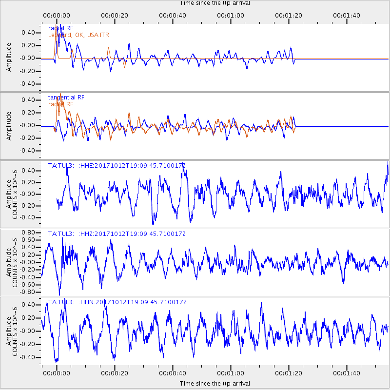
TUL3 Leonard, OK, USA - Earthquake Result Viewer
*The percent match for this event was below the threshold and hence no stack was calculated.
| Earthquake location: |
Cordoba Province, Argentina |
| Earthquake latitude/longitude: |
-31.0/-65.6 |
| Earthquake time(UTC): |
2017/10/12 (285) 18:59:08 GMT |
| Earthquake Depth: |
157 km |
| Earthquake Magnitude: |
5.5 Mww |
| Earthquake Catalog/Contributor: |
NEIC PDE/us |
|
| Network: |
TA USArray Transportable Network (new EarthScope stations) |
| Station: |
TUL3 Leonard, OK, USA |
| Lat/Lon: |
35.91 N/95.79 W |
| Elevation: |
265 m |
|
| Distance: |
72.4 deg |
| Az: |
334.615 deg |
| Baz: |
153.036 deg |
| Ray Param: |
$rayparam |
*The percent match for this event was below the threshold and hence was not used in the summary stack. |
|
| Radial Match: |
76.52652 % |
| Radial Bump: |
400 |
| Transverse Match: |
43.90584 % |
| Transverse Bump: |
400 |
| SOD ConfigId: |
13570011 |
| Insert Time: |
2019-04-28 23:46:04.399 +0000 |
| GWidth: |
2.5 |
| Max Bumps: |
400 |
| Tol: |
0.001 |
|
Signal To Noise
| Channel | StoN | STA | LTA |
| TA:TUL3: :HHZ:20171012T19:09:45.710017Z | 1.9974333 | 3.6043826E-7 | 1.8045071E-7 |
| TA:TUL3: :HHN:20171012T19:09:45.710017Z | 1.9057353 | 2.973572E-7 | 1.560328E-7 |
| TA:TUL3: :HHE:20171012T19:09:45.710017Z | 1.7801378 | 2.5512693E-7 | 1.4331864E-7 |
| Arrivals |
| Ps | |
| PpPs | |
| PsPs/PpSs | |


