You are here: Home > Network List > TA - USArray Transportable Network (new EarthScope stations) Stations List
> Station G31M Satah River, YT, CAN > Earthquake Result Viewer
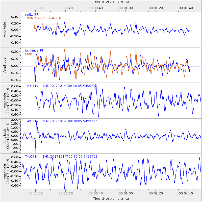
G31M Satah River, YT, CAN - Earthquake Result Viewer
*The percent match for this event was below the threshold and hence no stack was calculated.
| Earthquake location: |
Oaxaca, Mexico |
| Earthquake latitude/longitude: |
16.2/-94.8 |
| Earthquake time(UTC): |
2017/10/14 (287) 00:20:57 GMT |
| Earthquake Depth: |
49 km |
| Earthquake Magnitude: |
5.5 Mww |
| Earthquake Catalog/Contributor: |
NEIC PDE/us |
|
| Network: |
TA USArray Transportable Network (new EarthScope stations) |
| Station: |
G31M Satah River, YT, CAN |
| Lat/Lon: |
66.92 N/134.27 W |
| Elevation: |
61 m |
|
| Distance: |
56.8 deg |
| Az: |
342.577 deg |
| Baz: |
133.141 deg |
| Ray Param: |
$rayparam |
*The percent match for this event was below the threshold and hence was not used in the summary stack. |
|
| Radial Match: |
59.430695 % |
| Radial Bump: |
400 |
| Transverse Match: |
43.16348 % |
| Transverse Bump: |
400 |
| SOD ConfigId: |
13570011 |
| Insert Time: |
2019-04-28 23:51:52.194 +0000 |
| GWidth: |
2.5 |
| Max Bumps: |
400 |
| Tol: |
0.001 |
|
Signal To Noise
| Channel | StoN | STA | LTA |
| TA:G31M: :BHZ:20171014T00:30:05.549971Z | 2.4372249 | 7.252359E-7 | 2.9756626E-7 |
| TA:G31M: :BHN:20171014T00:30:05.549971Z | 1.2204795 | 2.8306314E-7 | 2.319278E-7 |
| TA:G31M: :BHE:20171014T00:30:05.549971Z | 1.1073129 | 2.2476428E-7 | 2.0298172E-7 |
| Arrivals |
| Ps | |
| PpPs | |
| PsPs/PpSs | |


