You are here: Home > Network List > UW - Pacific Northwest Regional Seismic Network Stations List
> Station YACT Amboy, WA, USA > Earthquake Result Viewer
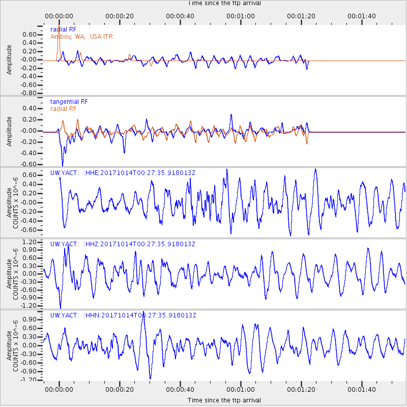
YACT Amboy, WA, USA - Earthquake Result Viewer
*The percent match for this event was below the threshold and hence no stack was calculated.
| Earthquake location: |
Oaxaca, Mexico |
| Earthquake latitude/longitude: |
16.2/-94.8 |
| Earthquake time(UTC): |
2017/10/14 (287) 00:20:57 GMT |
| Earthquake Depth: |
49 km |
| Earthquake Magnitude: |
5.5 Mww |
| Earthquake Catalog/Contributor: |
NEIC PDE/us |
|
| Network: |
UW Pacific Northwest Regional Seismic Network |
| Station: |
YACT Amboy, WA, USA |
| Lat/Lon: |
45.93 N/122.42 W |
| Elevation: |
211 m |
|
| Distance: |
37.5 deg |
| Az: |
327.933 deg |
| Baz: |
133.048 deg |
| Ray Param: |
$rayparam |
*The percent match for this event was below the threshold and hence was not used in the summary stack. |
|
| Radial Match: |
44.89146 % |
| Radial Bump: |
400 |
| Transverse Match: |
74.40842 % |
| Transverse Bump: |
400 |
| SOD ConfigId: |
13570011 |
| Insert Time: |
2019-04-28 23:53:04.149 +0000 |
| GWidth: |
2.5 |
| Max Bumps: |
400 |
| Tol: |
0.001 |
|
Signal To Noise
| Channel | StoN | STA | LTA |
| UW:YACT: :HHZ:20171014T00:27:35.918013Z | 2.8655083 | 6.4478064E-7 | 2.2501442E-7 |
| UW:YACT: :HHN:20171014T00:27:35.918013Z | 0.99787295 | 3.2502848E-7 | 3.2572132E-7 |
| UW:YACT: :HHE:20171014T00:27:35.918013Z | 1.5183342 | 2.8801912E-7 | 1.8969416E-7 |
| Arrivals |
| Ps | |
| PpPs | |
| PsPs/PpSs | |


