You are here: Home > Network List > CI - Caltech Regional Seismic Network Stations List
> Station SMM Simmler, CA, USA > Earthquake Result Viewer
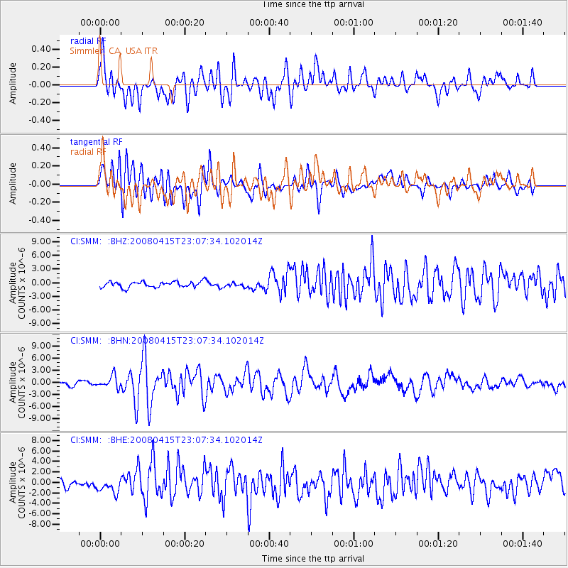
SMM Simmler, CA, USA - Earthquake Result Viewer
*The percent match for this event was below the threshold and hence no stack was calculated.
| Earthquake location: |
Andreanof Islands, Aleutian Is. |
| Earthquake latitude/longitude: |
51.9/-179.4 |
| Earthquake time(UTC): |
2008/04/15 (106) 22:59:51 GMT |
| Earthquake Depth: |
10 km |
| Earthquake Magnitude: |
6.1 MB, 6.4 MS, 6.4 MW, 6.4 MW |
| Earthquake Catalog/Contributor: |
WHDF/NEIC |
|
| Network: |
CI Caltech Regional Seismic Network |
| Station: |
SMM Simmler, CA, USA |
| Lat/Lon: |
35.31 N/120.00 W |
| Elevation: |
599 m |
|
| Distance: |
44.8 deg |
| Az: |
87.558 deg |
| Baz: |
310.737 deg |
| Ray Param: |
$rayparam |
*The percent match for this event was below the threshold and hence was not used in the summary stack. |
|
| Radial Match: |
79.14768 % |
| Radial Bump: |
400 |
| Transverse Match: |
72.94332 % |
| Transverse Bump: |
400 |
| SOD ConfigId: |
2504 |
| Insert Time: |
2010-02-26 01:32:17.980 +0000 |
| GWidth: |
2.5 |
| Max Bumps: |
400 |
| Tol: |
0.001 |
|
Signal To Noise
| Channel | StoN | STA | LTA |
| CI:SMM: :BHN:20080415T23:07:34.102014Z | 3.4117305 | 1.5392446E-6 | 4.5116244E-7 |
| CI:SMM: :BHE:20080415T23:07:34.102014Z | 1.215598 | 1.105521E-6 | 9.094463E-7 |
| CI:SMM: :BHZ:20080415T23:07:34.102014Z | 0.6986908 | 4.4055915E-7 | 6.3054955E-7 |
| Arrivals |
| Ps | |
| PpPs | |
| PsPs/PpSs | |


