You are here: Home > Network List > CI - Caltech Regional Seismic Network Stations List
> Station MLAC Mammoth Lakes, California, USA > Earthquake Result Viewer
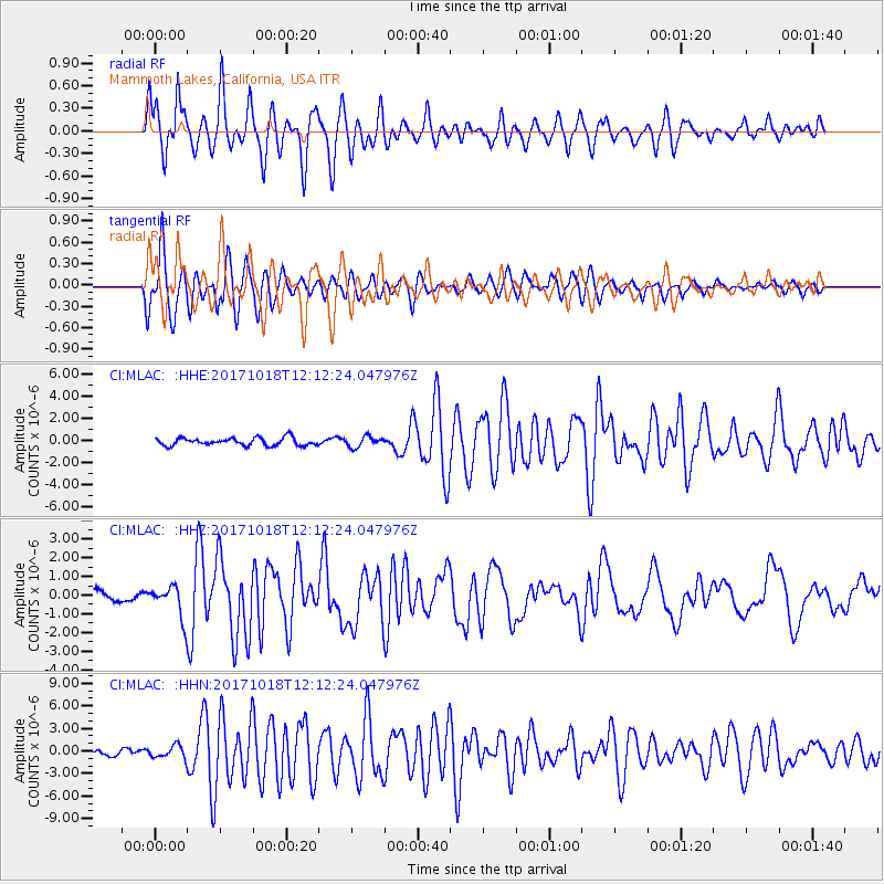
MLAC Mammoth Lakes, California, USA - Earthquake Result Viewer
*The percent match for this event was below the threshold and hence no stack was calculated.
| Earthquake location: |
Tonga Islands |
| Earthquake latitude/longitude: |
-20.6/-173.9 |
| Earthquake time(UTC): |
2017/10/18 (291) 12:00:59 GMT |
| Earthquake Depth: |
10 km |
| Earthquake Magnitude: |
6.0 Mww |
| Earthquake Catalog/Contributor: |
NEIC PDE/us |
|
| Network: |
CI Caltech Regional Seismic Network |
| Station: |
MLAC Mammoth Lakes, California, USA |
| Lat/Lon: |
37.63 N/118.84 W |
| Elevation: |
2134 m |
|
| Distance: |
77.7 deg |
| Az: |
41.772 deg |
| Baz: |
231.82 deg |
| Ray Param: |
$rayparam |
*The percent match for this event was below the threshold and hence was not used in the summary stack. |
|
| Radial Match: |
82.03857 % |
| Radial Bump: |
400 |
| Transverse Match: |
72.82182 % |
| Transverse Bump: |
400 |
| SOD ConfigId: |
13570011 |
| Insert Time: |
2019-04-28 23:56:46.704 +0000 |
| GWidth: |
2.5 |
| Max Bumps: |
400 |
| Tol: |
0.001 |
|
Signal To Noise
| Channel | StoN | STA | LTA |
| CI:MLAC: :HHZ:20171018T12:12:24.047976Z | 3.4438705 | 8.985433E-7 | 2.6091087E-7 |
| CI:MLAC: :HHN:20171018T12:12:24.047976Z | 2.6395538 | 8.519107E-7 | 3.2274798E-7 |
| CI:MLAC: :HHE:20171018T12:12:24.047976Z | 1.2752057 | 4.4090012E-7 | 3.4574825E-7 |
| Arrivals |
| Ps | |
| PpPs | |
| PsPs/PpSs | |


