You are here: Home > Network List > TA - USArray Transportable Network (new EarthScope stations) Stations List
> Station B18K Kokolik River, AK, USA > Earthquake Result Viewer
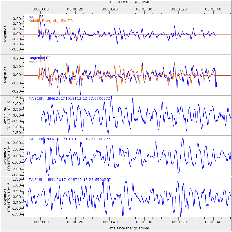
B18K Kokolik River, AK, USA - Earthquake Result Viewer
*The percent match for this event was below the threshold and hence no stack was calculated.
| Earthquake location: |
Tonga Islands |
| Earthquake latitude/longitude: |
-20.6/-173.9 |
| Earthquake time(UTC): |
2017/10/18 (291) 12:00:59 GMT |
| Earthquake Depth: |
10 km |
| Earthquake Magnitude: |
6.0 Mww |
| Earthquake Catalog/Contributor: |
NEIC PDE/us |
|
| Network: |
TA USArray Transportable Network (new EarthScope stations) |
| Station: |
B18K Kokolik River, AK, USA |
| Lat/Lon: |
69.36 N/161.80 W |
| Elevation: |
222 m |
|
| Distance: |
90.1 deg |
| Az: |
4.259 deg |
| Baz: |
191.319 deg |
| Ray Param: |
$rayparam |
*The percent match for this event was below the threshold and hence was not used in the summary stack. |
|
| Radial Match: |
53.72691 % |
| Radial Bump: |
400 |
| Transverse Match: |
47.935238 % |
| Transverse Bump: |
400 |
| SOD ConfigId: |
13570011 |
| Insert Time: |
2019-04-29 00:00:51.598 +0000 |
| GWidth: |
2.5 |
| Max Bumps: |
400 |
| Tol: |
0.001 |
|
Signal To Noise
| Channel | StoN | STA | LTA |
| TA:B18K: :BHZ:20171018T12:13:27.650027Z | 3.679974 | 1.7995558E-6 | 4.8901313E-7 |
| TA:B18K: :BHN:20171018T12:13:27.650027Z | 0.82546234 | 4.3926437E-7 | 5.321435E-7 |
| TA:B18K: :BHE:20171018T12:13:27.650027Z | 0.80645317 | 4.8606233E-7 | 6.0271617E-7 |
| Arrivals |
| Ps | |
| PpPs | |
| PsPs/PpSs | |


