You are here: Home > Network List > TA - USArray Transportable Network (new EarthScope stations) Stations List
> Station E20K Nigu River, AK, USA > Earthquake Result Viewer
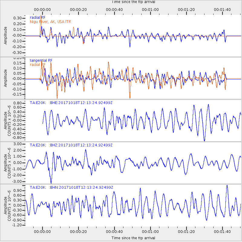
E20K Nigu River, AK, USA - Earthquake Result Viewer
*The percent match for this event was below the threshold and hence no stack was calculated.
| Earthquake location: |
Tonga Islands |
| Earthquake latitude/longitude: |
-20.6/-173.9 |
| Earthquake time(UTC): |
2017/10/18 (291) 12:00:59 GMT |
| Earthquake Depth: |
10 km |
| Earthquake Magnitude: |
6.0 Mww |
| Earthquake Catalog/Contributor: |
NEIC PDE/us |
|
| Network: |
TA USArray Transportable Network (new EarthScope stations) |
| Station: |
E20K Nigu River, AK, USA |
| Lat/Lon: |
68.26 N/156.19 W |
| Elevation: |
866 m |
|
| Distance: |
89.5 deg |
| Az: |
6.507 deg |
| Baz: |
196.555 deg |
| Ray Param: |
$rayparam |
*The percent match for this event was below the threshold and hence was not used in the summary stack. |
|
| Radial Match: |
59.255787 % |
| Radial Bump: |
400 |
| Transverse Match: |
55.900135 % |
| Transverse Bump: |
400 |
| SOD ConfigId: |
13570011 |
| Insert Time: |
2019-04-29 00:01:04.766 +0000 |
| GWidth: |
2.5 |
| Max Bumps: |
400 |
| Tol: |
0.001 |
|
Signal To Noise
| Channel | StoN | STA | LTA |
| TA:E20K: :BHZ:20171018T12:13:24.92499Z | 3.1648605 | 1.3306687E-6 | 4.2045096E-7 |
| TA:E20K: :BHN:20171018T12:13:24.92499Z | 0.73612 | 2.2332078E-7 | 3.0337551E-7 |
| TA:E20K: :BHE:20171018T12:13:24.92499Z | 1.1067019 | 2.8063604E-7 | 2.5357872E-7 |
| Arrivals |
| Ps | |
| PpPs | |
| PsPs/PpSs | |


