You are here: Home > Network List > CI - Caltech Regional Seismic Network Stations List
> Station SMM Simmler, CA, USA > Earthquake Result Viewer
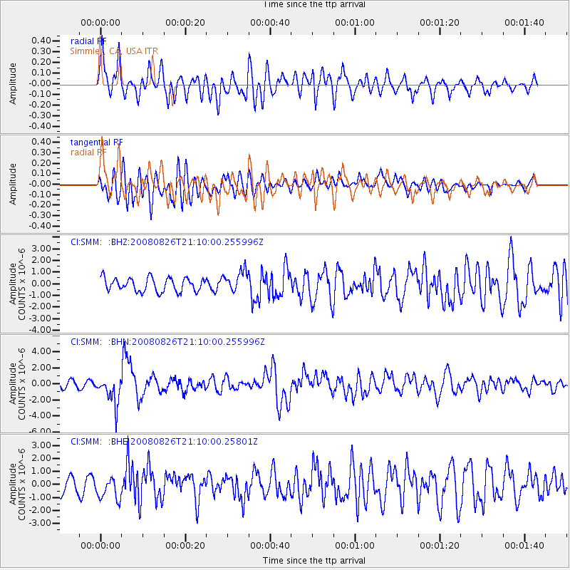
SMM Simmler, CA, USA - Earthquake Result Viewer
*The percent match for this event was below the threshold and hence no stack was calculated.
| Earthquake location: |
Peru-Brazil Border Region |
| Earthquake latitude/longitude: |
-7.6/-74.4 |
| Earthquake time(UTC): |
2008/08/26 (239) 21:00:36 GMT |
| Earthquake Depth: |
154 km |
| Earthquake Magnitude: |
6.0 MB, 6.4 MW, 6.4 MW |
| Earthquake Catalog/Contributor: |
WHDF/NEIC |
|
| Network: |
CI Caltech Regional Seismic Network |
| Station: |
SMM Simmler, CA, USA |
| Lat/Lon: |
35.31 N/120.00 W |
| Elevation: |
599 m |
|
| Distance: |
60.6 deg |
| Az: |
317.861 deg |
| Baz: |
125.59 deg |
| Ray Param: |
$rayparam |
*The percent match for this event was below the threshold and hence was not used in the summary stack. |
|
| Radial Match: |
69.63224 % |
| Radial Bump: |
400 |
| Transverse Match: |
75.39965 % |
| Transverse Bump: |
400 |
| SOD ConfigId: |
2504 |
| Insert Time: |
2010-02-26 01:32:23.286 +0000 |
| GWidth: |
2.5 |
| Max Bumps: |
400 |
| Tol: |
0.001 |
|
Signal To Noise
| Channel | StoN | STA | LTA |
| CI:SMM: :BHN:20080826T21:10:00.255996Z | 4.756892 | 1.763552E-6 | 3.7073616E-7 |
| CI:SMM: :BHE:20080826T21:10:00.25801Z | 1.1995084 | 8.3042784E-7 | 6.923068E-7 |
| CI:SMM: :BHZ:20080826T21:10:00.255996Z | 1.5677278 | 9.1096376E-7 | 5.8107264E-7 |
| Arrivals |
| Ps | |
| PpPs | |
| PsPs/PpSs | |


