You are here: Home > Network List > GS - US Geological Survey Networks Stations List
> Station DEC06 Boomer, Decatur, IL, USA > Earthquake Result Viewer
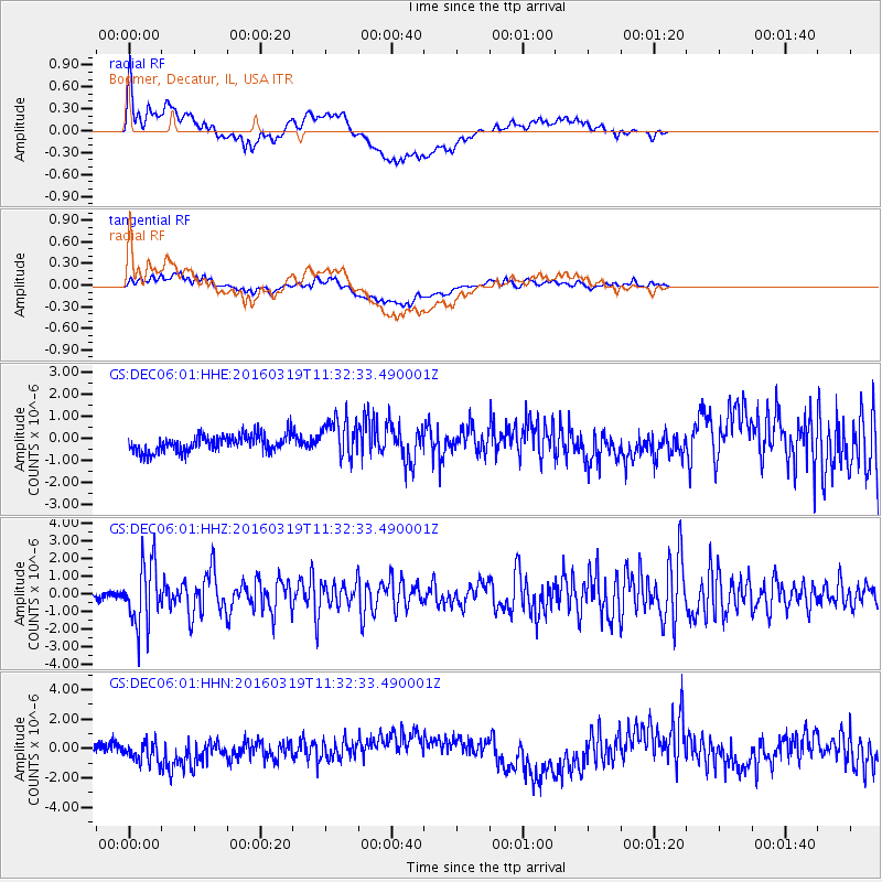
DEC06 Boomer, Decatur, IL, USA - Earthquake Result Viewer
*The percent match for this event was below the threshold and hence no stack was calculated.
| Earthquake location: |
Leeward Islands |
| Earthquake latitude/longitude: |
18.0/-60.7 |
| Earthquake time(UTC): |
2016/03/19 (079) 11:26:34 GMT |
| Earthquake Depth: |
32 km |
| Earthquake Magnitude: |
6.0 MWW, 5.9 MWB |
| Earthquake Catalog/Contributor: |
NEIC PDE/NEIC COMCAT |
|
| Network: |
GS US Geological Survey Networks |
| Station: |
DEC06 Boomer, Decatur, IL, USA |
| Lat/Lon: |
39.90 N/88.95 W |
| Elevation: |
215 m |
|
| Distance: |
32.7 deg |
| Az: |
317.688 deg |
| Baz: |
123.616 deg |
| Ray Param: |
$rayparam |
*The percent match for this event was below the threshold and hence was not used in the summary stack. |
|
| Radial Match: |
65.66922 % |
| Radial Bump: |
400 |
| Transverse Match: |
33.0496 % |
| Transverse Bump: |
400 |
| SOD ConfigId: |
1464191 |
| Insert Time: |
2016-04-02 12:00:19.488 +0000 |
| GWidth: |
2.5 |
| Max Bumps: |
400 |
| Tol: |
0.001 |
|
Signal To Noise
| Channel | StoN | STA | LTA |
| GS:DEC06:01:HHZ:20160319T11:32:33.490001Z | 10.209662 | 1.761972E-6 | 1.7257886E-7 |
| GS:DEC06:01:HHN:20160319T11:32:33.490001Z | 1.6456155 | 6.574352E-7 | 3.9950717E-7 |
| GS:DEC06:01:HHE:20160319T11:32:33.490001Z | 2.3513355 | 9.077448E-7 | 3.8605495E-7 |
| Arrivals |
| Ps | |
| PpPs | |
| PsPs/PpSs | |


