You are here: Home > Network List > CI - Caltech Regional Seismic Network Stations List
> Station SMM Simmler, CA, USA > Earthquake Result Viewer
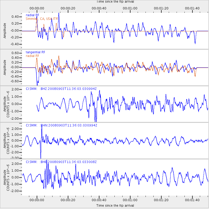
SMM Simmler, CA, USA - Earthquake Result Viewer
*The percent match for this event was below the threshold and hence no stack was calculated.
| Earthquake location: |
Santiago Del Estero Prov., Arg. |
| Earthquake latitude/longitude: |
-26.7/-63.2 |
| Earthquake time(UTC): |
2008/09/03 (247) 11:25:14 GMT |
| Earthquake Depth: |
570 km |
| Earthquake Magnitude: |
5.9 MB, 6.3 MW, 6.3 MW |
| Earthquake Catalog/Contributor: |
WHDF/NEIC |
|
| Network: |
CI Caltech Regional Seismic Network |
| Station: |
SMM Simmler, CA, USA |
| Lat/Lon: |
35.31 N/120.00 W |
| Elevation: |
599 m |
|
| Distance: |
81.8 deg |
| Az: |
316.273 deg |
| Baz: |
130.899 deg |
| Ray Param: |
$rayparam |
*The percent match for this event was below the threshold and hence was not used in the summary stack. |
|
| Radial Match: |
59.019814 % |
| Radial Bump: |
400 |
| Transverse Match: |
50.23185 % |
| Transverse Bump: |
400 |
| SOD ConfigId: |
2504 |
| Insert Time: |
2010-02-26 01:32:26.455 +0000 |
| GWidth: |
2.5 |
| Max Bumps: |
400 |
| Tol: |
0.001 |
|
Signal To Noise
| Channel | StoN | STA | LTA |
| CI:SMM: :BHN:20080903T11:36:03.030994Z | 1.8635467 | 8.8972644E-7 | 4.7743714E-7 |
| CI:SMM: :BHE:20080903T11:36:03.033008Z | 1.5186541 | 6.023837E-7 | 3.966563E-7 |
| CI:SMM: :BHZ:20080903T11:36:03.030994Z | 1.8472314 | 8.623066E-7 | 4.6681026E-7 |
| Arrivals |
| Ps | |
| PpPs | |
| PsPs/PpSs | |


