You are here: Home > Network List > TA - USArray Transportable Network (new EarthScope stations) Stations List
> Station P17K Kvichak River, AK, USA > Earthquake Result Viewer
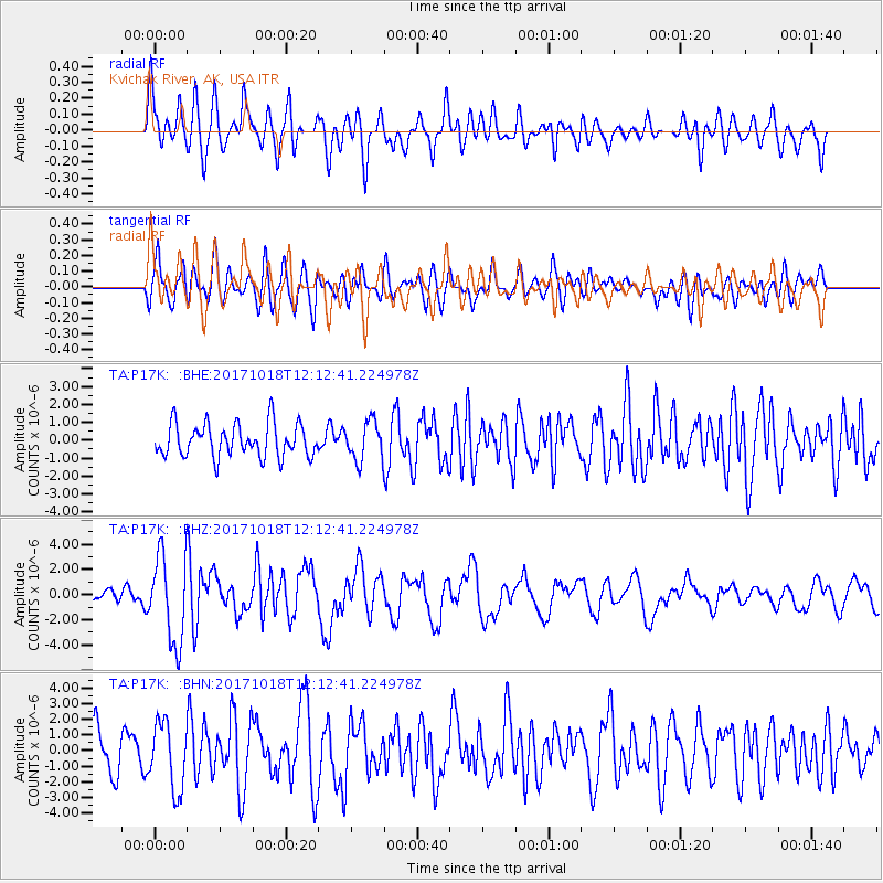
P17K Kvichak River, AK, USA - Earthquake Result Viewer
*The percent match for this event was below the threshold and hence no stack was calculated.
| Earthquake location: |
Tonga Islands |
| Earthquake latitude/longitude: |
-20.6/-173.9 |
| Earthquake time(UTC): |
2017/10/18 (291) 12:00:59 GMT |
| Earthquake Depth: |
10 km |
| Earthquake Magnitude: |
6.0 Mww |
| Earthquake Catalog/Contributor: |
NEIC PDE/us |
|
| Network: |
TA USArray Transportable Network (new EarthScope stations) |
| Station: |
P17K Kvichak River, AK, USA |
| Lat/Lon: |
59.20 N/156.44 W |
| Elevation: |
91 m |
|
| Distance: |
80.8 deg |
| Az: |
8.998 deg |
| Baz: |
196.54 deg |
| Ray Param: |
$rayparam |
*The percent match for this event was below the threshold and hence was not used in the summary stack. |
|
| Radial Match: |
72.26084 % |
| Radial Bump: |
400 |
| Transverse Match: |
68.31525 % |
| Transverse Bump: |
400 |
| SOD ConfigId: |
13570011 |
| Insert Time: |
2019-04-29 00:02:41.673 +0000 |
| GWidth: |
2.5 |
| Max Bumps: |
400 |
| Tol: |
0.001 |
|
Signal To Noise
| Channel | StoN | STA | LTA |
| TA:P17K: :BHZ:20171018T12:12:41.224978Z | 6.7029257 | 3.5344024E-6 | 5.272925E-7 |
| TA:P17K: :BHN:20171018T12:12:41.224978Z | 1.9578037 | 2.1310386E-6 | 1.0884843E-6 |
| TA:P17K: :BHE:20171018T12:12:41.224978Z | 1.4971156 | 1.3794235E-6 | 9.213874E-7 |
| Arrivals |
| Ps | |
| PpPs | |
| PsPs/PpSs | |


