You are here: Home > Network List > TA - USArray Transportable Network (new EarthScope stations) Stations List
> Station R32K Eaglecrest, AK, USA > Earthquake Result Viewer
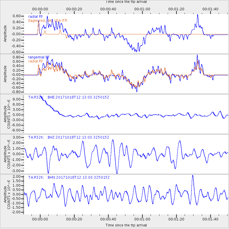
R32K Eaglecrest, AK, USA - Earthquake Result Viewer
*The percent match for this event was below the threshold and hence no stack was calculated.
| Earthquake location: |
Tonga Islands |
| Earthquake latitude/longitude: |
-20.6/-173.9 |
| Earthquake time(UTC): |
2017/10/18 (291) 12:00:59 GMT |
| Earthquake Depth: |
10 km |
| Earthquake Magnitude: |
6.0 Mww |
| Earthquake Catalog/Contributor: |
NEIC PDE/us |
|
| Network: |
TA USArray Transportable Network (new EarthScope stations) |
| Station: |
R32K Eaglecrest, AK, USA |
| Lat/Lon: |
58.27 N/134.52 W |
| Elevation: |
386 m |
|
| Distance: |
85.1 deg |
| Az: |
19.662 deg |
| Baz: |
216.623 deg |
| Ray Param: |
$rayparam |
*The percent match for this event was below the threshold and hence was not used in the summary stack. |
|
| Radial Match: |
30.431408 % |
| Radial Bump: |
400 |
| Transverse Match: |
30.459488 % |
| Transverse Bump: |
400 |
| SOD ConfigId: |
13570011 |
| Insert Time: |
2019-04-29 00:02:53.153 +0000 |
| GWidth: |
2.5 |
| Max Bumps: |
400 |
| Tol: |
0.001 |
|
Signal To Noise
| Channel | StoN | STA | LTA |
| TA:R32K: :BHZ:20171018T12:13:03.325015Z | 2.0031776 | 1.3174501E-6 | 6.576802E-7 |
| TA:R32K: :BHN:20171018T12:13:03.325015Z | 0.6577937 | 4.352401E-7 | 6.6166655E-7 |
| TA:R32K: :BHE:20171018T12:13:03.325015Z | 0.9666756 | 3.1403545E-6 | 3.2486128E-6 |
| Arrivals |
| Ps | |
| PpPs | |
| PsPs/PpSs | |


