You are here: Home > Network List > UW - Pacific Northwest Regional Seismic Network Stations List
> Station MRBL Marblemount, WA, USA > Earthquake Result Viewer
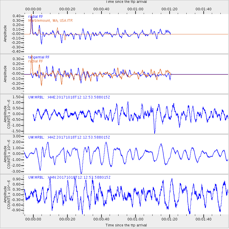
MRBL Marblemount, WA, USA - Earthquake Result Viewer
*The percent match for this event was below the threshold and hence no stack was calculated.
| Earthquake location: |
Tonga Islands |
| Earthquake latitude/longitude: |
-20.6/-173.9 |
| Earthquake time(UTC): |
2017/10/18 (291) 12:00:59 GMT |
| Earthquake Depth: |
10 km |
| Earthquake Magnitude: |
6.0 Mww |
| Earthquake Catalog/Contributor: |
NEIC PDE/us |
|
| Network: |
UW Pacific Northwest Regional Seismic Network |
| Station: |
MRBL Marblemount, WA, USA |
| Lat/Lon: |
48.52 N/121.48 W |
| Elevation: |
75 m |
|
| Distance: |
83.2 deg |
| Az: |
32.046 deg |
| Baz: |
228.387 deg |
| Ray Param: |
$rayparam |
*The percent match for this event was below the threshold and hence was not used in the summary stack. |
|
| Radial Match: |
76.90699 % |
| Radial Bump: |
400 |
| Transverse Match: |
55.184586 % |
| Transverse Bump: |
400 |
| SOD ConfigId: |
13570011 |
| Insert Time: |
2019-04-29 00:03:54.375 +0000 |
| GWidth: |
2.5 |
| Max Bumps: |
400 |
| Tol: |
0.001 |
|
Signal To Noise
| Channel | StoN | STA | LTA |
| UW:MRBL: :HHZ:20171018T12:12:53.588015Z | 4.40582 | 1.1905132E-6 | 2.7021377E-7 |
| UW:MRBL: :HHN:20171018T12:12:53.588015Z | 1.1043941 | 2.4682814E-7 | 2.2349644E-7 |
| UW:MRBL: :HHE:20171018T12:12:53.588015Z | 1.4337821 | 3.4680892E-7 | 2.4188398E-7 |
| Arrivals |
| Ps | |
| PpPs | |
| PsPs/PpSs | |


