You are here: Home > Network List > TJ - Tajikistan National Seismic Network Stations List
> Station GARM Garm, Tajikistan > Earthquake Result Viewer
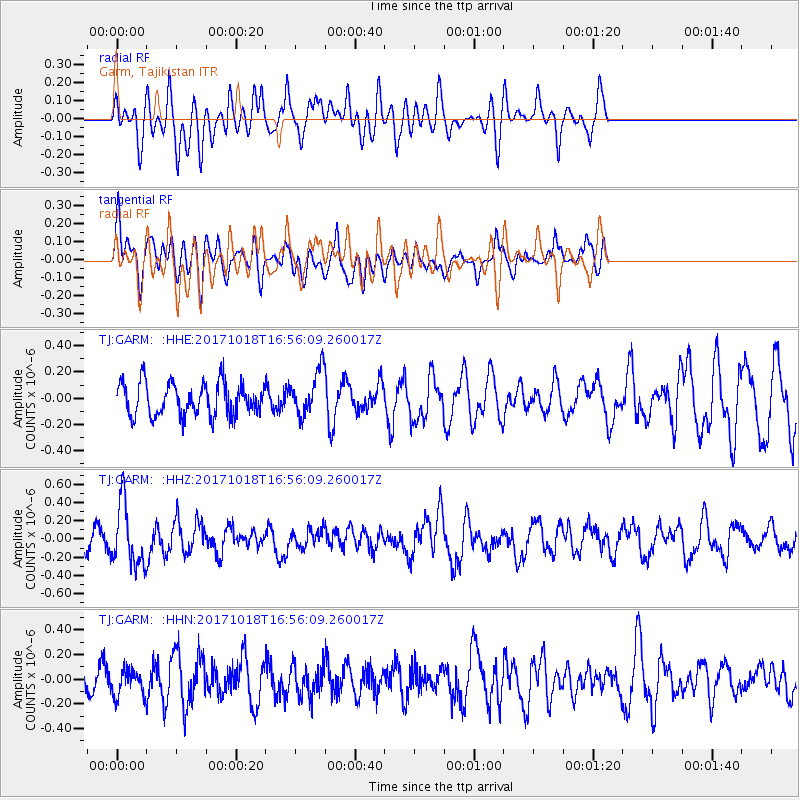
GARM Garm, Tajikistan - Earthquake Result Viewer
*The percent match for this event was below the threshold and hence no stack was calculated.
| Earthquake location: |
Eastern New Guinea Reg., P.N.G. |
| Earthquake latitude/longitude: |
-5.6/147.2 |
| Earthquake time(UTC): |
2017/10/18 (291) 16:44:35 GMT |
| Earthquake Depth: |
193 km |
| Earthquake Magnitude: |
5.6 Mww |
| Earthquake Catalog/Contributor: |
NEIC PDE/us |
|
| Network: |
TJ Tajikistan National Seismic Network |
| Station: |
GARM Garm, Tajikistan |
| Lat/Lon: |
39.00 N/70.32 E |
| Elevation: |
1305 m |
|
| Distance: |
83.3 deg |
| Az: |
310.184 deg |
| Baz: |
102.607 deg |
| Ray Param: |
$rayparam |
*The percent match for this event was below the threshold and hence was not used in the summary stack. |
|
| Radial Match: |
54.594616 % |
| Radial Bump: |
400 |
| Transverse Match: |
58.41993 % |
| Transverse Bump: |
400 |
| SOD ConfigId: |
13570011 |
| Insert Time: |
2019-04-29 00:11:07.052 +0000 |
| GWidth: |
2.5 |
| Max Bumps: |
400 |
| Tol: |
0.001 |
|
Signal To Noise
| Channel | StoN | STA | LTA |
| TJ:GARM: :HHZ:20171018T16:56:09.260017Z | 3.068964 | 3.3508775E-7 | 1.0918594E-7 |
| TJ:GARM: :HHN:20171018T16:56:09.260017Z | 1.1597066 | 1.0665721E-7 | 9.1969135E-8 |
| TJ:GARM: :HHE:20171018T16:56:09.260017Z | 1.3219357 | 1.6406896E-7 | 1.2411267E-7 |
| Arrivals |
| Ps | |
| PpPs | |
| PsPs/PpSs | |


