You are here: Home > Network List > AK - Alaska Regional Network Stations List
> Station CUT Chulitna, AK, USA > Earthquake Result Viewer
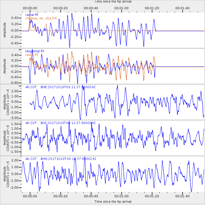
CUT Chulitna, AK, USA - Earthquake Result Viewer
*The percent match for this event was below the threshold and hence no stack was calculated.
| Earthquake location: |
Southeast Of Ryukyu Islands |
| Earthquake latitude/longitude: |
28.3/131.2 |
| Earthquake time(UTC): |
2017/10/19 (292) 09:02:01 GMT |
| Earthquake Depth: |
10 km |
| Earthquake Magnitude: |
5.8 Mww |
| Earthquake Catalog/Contributor: |
NEIC PDE/us |
|
| Network: |
AK Alaska Regional Network |
| Station: |
CUT Chulitna, AK, USA |
| Lat/Lon: |
62.41 N/150.26 W |
| Elevation: |
574 m |
|
| Distance: |
60.1 deg |
| Az: |
31.783 deg |
| Baz: |
274.282 deg |
| Ray Param: |
$rayparam |
*The percent match for this event was below the threshold and hence was not used in the summary stack. |
|
| Radial Match: |
50.192715 % |
| Radial Bump: |
400 |
| Transverse Match: |
64.75184 % |
| Transverse Bump: |
400 |
| SOD ConfigId: |
13570011 |
| Insert Time: |
2019-04-29 00:12:11.750 +0000 |
| GWidth: |
2.5 |
| Max Bumps: |
400 |
| Tol: |
0.001 |
|
Signal To Noise
| Channel | StoN | STA | LTA |
| AK:CUT: :BHZ:20171019T09:11:37.800024Z | 1.2426554 | 5.280828E-7 | 4.2496322E-7 |
| AK:CUT: :BHN:20171019T09:11:37.800024Z | 0.7169145 | 9.316782E-7 | 1.2995666E-6 |
| AK:CUT: :BHE:20171019T09:11:37.800024Z | 2.207874 | 1.7213147E-6 | 7.7962534E-7 |
| Arrivals |
| Ps | |
| PpPs | |
| PsPs/PpSs | |


