You are here: Home > Network List > IW - Intermountain West Stations List
> Station DLMT Dillon, Montana, USA > Earthquake Result Viewer
DLMT Dillon, Montana, USA - Earthquake Result Viewer
*The percent match for this event was below the threshold and hence no stack was calculated.
| Earthquake location: |
Leeward Islands |
| Earthquake latitude/longitude: |
18.0/-60.7 |
| Earthquake time(UTC): |
2016/03/19 (079) 11:26:34 GMT |
| Earthquake Depth: |
32 km |
| Earthquake Magnitude: |
6.0 MWW, 5.9 MWB |
| Earthquake Catalog/Contributor: |
NEIC PDE/NEIC COMCAT |
|
| Network: |
IW Intermountain West |
| Station: |
DLMT Dillon, Montana, USA |
| Lat/Lon: |
45.36 N/112.60 W |
| Elevation: |
1569 m |
|
| Distance: |
50.8 deg |
| Az: |
314.301 deg |
| Baz: |
104.958 deg |
| Ray Param: |
$rayparam |
*The percent match for this event was below the threshold and hence was not used in the summary stack. |
|
| Radial Match: |
75.68209 % |
| Radial Bump: |
400 |
| Transverse Match: |
56.28829 % |
| Transverse Bump: |
400 |
| SOD ConfigId: |
1464191 |
| Insert Time: |
2016-04-02 12:04:47.197 +0000 |
| GWidth: |
2.5 |
| Max Bumps: |
400 |
| Tol: |
0.001 |
|
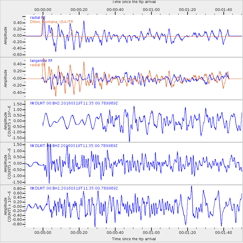
Signal To Noise
| Channel | StoN | STA | LTA |
| IW:DLMT:00:BHZ:20160319T11:35:00.789989Z | 3.7058506 | 7.593113E-7 | 2.0489529E-7 |
| IW:DLMT:00:BH1:20160319T11:35:00.789989Z | 1.3914418 | 2.0271506E-7 | 1.4568705E-7 |
| IW:DLMT:00:BH2:20160319T11:35:00.789989Z | 1.3811548 | 4.5159194E-7 | 3.2696695E-7 |
| Arrivals |
| Ps | |
| PpPs | |
| PsPs/PpSs | |


